Cave Formation in the Ozarks

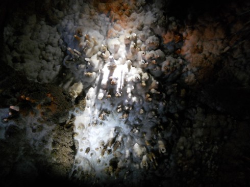
Ceiling of Twin Cave.

Rain falls.
Some runs off,
Some seeps into the ground.
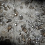
Water drips from the tips of limestone straws on the roof of Twins Cave.

It trickles through soil.
Leaching acids, organic,
Out of the leaf litter,

But even without these,
It’s already, every so slightly, corrosive,
From just the carbon dioxide in the air.

Gravity driven,
The seeping water seeks the bedrock,
Where it might find,
In the Ozark Mountains,
Limestone.
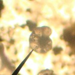
Planktonic shell (from Coon Creek which is 30 million years old, compared to the limestone rocks in the Ozarks which are 300 million years old.)

Limestone:
Microscopic shells, of plankton,
Raining down, over millenia,
Compacting into rocks,
In a closing ocean,
As North America and Africa collide,
From the Devonian to the Carboniferous.

Orogenic uplift,
Ocean-floor rocks,
Become mountains,

Appalachians, Ouachitas,
The Ozark Plateau.
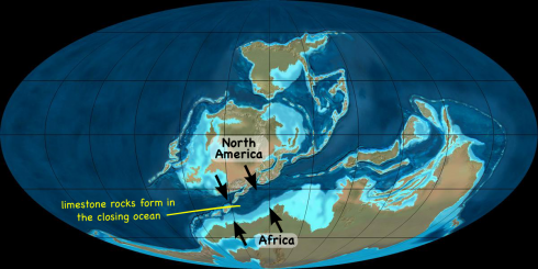
The collision of North America and Africa uplifted the limestone rocks from the closing ocean (the Rheic Ocean) to create the Ouachita Mountains and Ozark Plateau. (Figure adapted from iimage by Dr. Ron Blakey - http://jan.ucc.nau.edu/~rcb7).

Limestone dissolves,
In acid water.
Shaping holes; caves in bedrock,
Where we go,
Exploring.

Crawling through the "Brith Canal".

The Saltwater Lens on Small Islands

The freshwater lens beneath small islands is fed by rainwater and maintained because the freshwater is less dense than the surrounding saltwater.

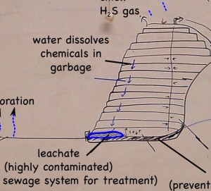
One of the questions that came up when we were talking about dealing with the highly contaminated leachate that drains out of landfills, is what would happen to it if it was just put into a lake or the ocean. Would the liquid just mix into the water, or would it stay separate.

Rainwater seeping through a landfill picks up a lot of nasty chemicals, and by the time it gets to the bottom it is a highly contaminated leachate.

I’m afraid I did not go with an easy answer. It depends after all on two things: how different the density is of the leachate from seawater; and how turbulent is the water.

Turbulent water will make the leachate more likely to mix, while a greater density difference would cause them to “want” to remain separate. An extremely dense leachate might just settle to the bottom of a lake and stay there.

Small Islands

One example of two fluids that are in contact but stay separate is in the groundwater beneath small islands. Rain water falls on the island and seeps into the ground. It’s fresh, but the water in the surrounding ocean and the water that’s already underground are both salty. Salty water is more dense than the fresh so the freshwater will float on top of the salty water creating a thin lens.

Dimensions of a freshwater lens. Image via the USGS.

How thick is the lens? For every meter that the fresh groundwater is above sea level, there are 40 meters of fresh water below sea level (1:40). This is because saltwater has density of about 1.025 g/cm3, while freshwater has a density of about 1.000 g/cm3 (note that I use four significant figures in each of these values).

The freshwater lens can be a great source of drinking water on these isolated small islands, but like the islands themselves, they are threatened by rising sea levels due to global warming.

Nearby Coal Plant’s Leaking Coal Ash Pond


View Ameren’s Coal Power Plant in a larger map

Jeffery Tomich had a good article last month on the leakage from the coal ash pond at a coal burning power plant near to our school. While the leakage appears to pose no real risk to us, it is a serious environmental issue at a local site that a number of students drive by on the way to school.

I’ve annotated the following excerpt from the article based on the questions my students asked when we talked about the it.

Since Since 1992, a coal ash pond next to the Ameren power plant here has been … hemorrhaging up to 35 gallons a minute [into the local groundwater].

At many [other] sites, trace metals in coal ash including lead, mercury, arsenic and selenium have been found in groundwater at levels that exceed drinking water standards.

In 2007, a U.S. Environmental Protection Agency report identified 63 sites in 26 states where the water was contaminated by heavy metals from coal ash dumps. That was more than a year before an estimated 5.4 million cubic yards of coal ash sludge escaped an impoundment in Kingston, Tenn. The sludge spread across 300 acres, and 3 million cubic yards spilled into a river.

The waste is created from burning coal to create electricity. At Labadie’s ash ponds, it’s composed of fly ash, a fine, talc-like powder that’s captured by filters in the plant’s stacks to reduce pollutants released into the air, and bottom ash, a coarser material that falls to the bottom of coal boilers.

a report prepared by Robert Criss, a Washington University professor, identified several dozen private wells along the bluffs near Labadie Bottoms that could be at risk of contamination. Contaminants could infiltrate from shallow alluvial soils to the deeper Ozark aquifer [(see also USGS, 2009)] tapped by residents for drinking water, according to the report.

Ameren believes the leaks don’t pose an environmental threat. But because of ongoing concerns, and because the EPA has asked the utility to monitor them, Ameren will make repairs to the ash pond by the end of the year

— Tomich (2011): Leaks from Ameren toxic waste pond in Labadie stir fears in St. Louis Today.

More information from the local environmental group, Labadie Environmental Organization:

The ash overflow in Tennessee: see Dewan, 2008.