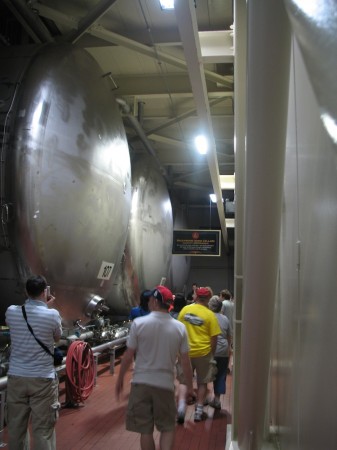
Glassworks

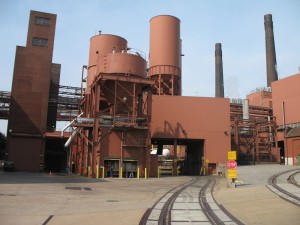
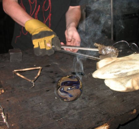
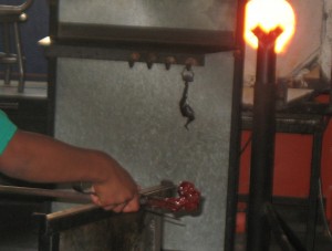
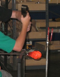
Molten glass, upwards of 2000 degrees, cools slowly, quickly, slow enough to pull, twist, fast enough to feel the brittleness between metal tweezers in seconds. Runny to viscous as it cools. Change of state — freezing — feel it in the glass.

Tweezers and jacks keep hot glass at a distance. Third class levers require balance and firmness to control their mechanical advantage.

Glass, silica, SiO2. Quartz crystals, ordered array of molecules. Glass, no organization, amorphous.

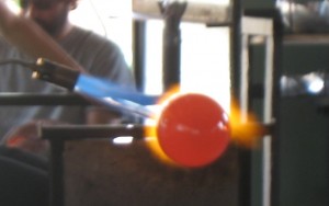
Furnaces blast hot, you can see the yellow-orange color, you can feel the hard infra-red light, thermal energy. IR – long wave – less energetic. When extra heat is needed, the blue/ultra-violet flame of propane (mixed with oxygen). UV – short wave – high energy – hard on the eyes though you can’t see it.

Combustion needs three things, heat, fuel and oxygen. Propane, C3H8, not methane, CH4 – the greater energy density. Propane, C3H8, not butane, C4H10 – is a gas not a liquid. To burn real hot needs extra oxygen.

Propane torch.

Conservation is a challenge. Furnaces –> heat –> lots of energy –> bad. Natural light, big doors, lots of windows. Recycle glass (at least the clear glass). No need for heat in the winter. Drink lots of water in the summer.

3rd Degree Glass Factory, make your own paperweights. About 12 minutes per person. Excellent way to spend a morning. Really cool faucets and water basins in the bathroom.

Lambert’s of Sikeston

Lambert’s Cafe is an interesting cultural icon. Seriously small-town and farm-country, the staff all wear red suspenders and bow ties. Seating in long wooden benches, and the drinks in enormous, reusable plastic cups. The cups really captures the ethos. Red, black and blue, they are cheap, thick walled and have see a lot of use, so much so that the logos and markings on many of them are coming off.

They also throw rolls to you from across the room. It’s their thing. It’s a lot of fun, although under and over throws can come as a bit of a surprise to the unsuspecting. Someone is always walking around with tins of sorghum mollasses and apple butter which are quite good.

At any rate, Lambert’s is located at a convenient half-way point between Memphis and St. Louis, so it makes for a reasonable break on the long drive.

[googleMap name=”Lambert’s Cafe” description=”Food stop” width=”400″ height=”350″ mapzoom=”6″ mousewheel=”false”]2305 E Malone Ave Sikeston, Missouri 63801[/googleMap]

Physics and history in Vicksburg, MS.

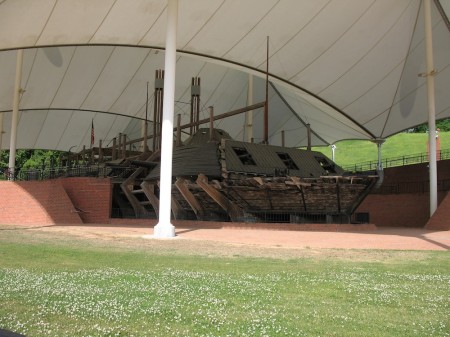
Salvage of the ironclad, USS Cairo, in Vicksburg National Military Park.

Four hours away, Vicksburg, MS. is just within reach for an immersion trip so, since we were in the area, I scoped it out for a future trip. Vicksburg was the final town to fall before the Union could control the Mississippi River and split the Confederacy into two, so it’s historically important. The Vicksburg National Military Park is chock full of monuments and markers that give a good idea about the chaos and carnage of the battle for the town, and even a chance to observe practical application of simple machines and steam engines.

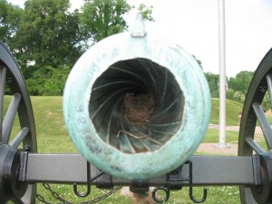
Rifling in a cannon.

The park could complement Shiloh and Corinth quite nicely since Vicksburg’s importance was because of its control of transportation routes, just like with Corinth. It also has the salvage of the USS Cairo, an ironclad sunk during the Civil War. Much of he Hull is still missing so it’s a wonderful chance to see all the mechanisms and engines in a steam powered ship.

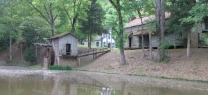
Watermill at Grand Gulf Military State Park.

What I found most interesting, however, were the old watermill and farming equipment at Grand Gulf Military Park, about 45 minutes south of Vicksburg. They seem almost in working order, and if you’ve been discussing simple machines, as we have, it’s a great opportunity to see how they were applied in real-life.

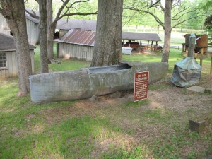
One-man submarine with bootlegger's still in background.

The watermill is quite picturesque, making it a great subject for sketching or drawing. I like to combine art and science in this way when possible. Grand Gulf also has a small, submarine used by bootleggers during prohibition which is quite the curious piece of engineering.

[googleMap name=”Grand Gulf Military State Park” description=”Watermill and camping” width=”400″ height=”300″ mapzoom=”8″ mousewheel=”false”]12006 Grand Gulf Rd, Port Gibson, MS[/googleMap]

Corinth Mississippi in the Civil War

Stream of American History at the Corinth Civil War Interpretive center.

The Memphis to Charleston line was the only railroad that linked the East Coast of the Confederacy to the fertile Mississippi River Valley. At a time when the fastest way to move troops, supplies and commerce was by river or rail, the Memphis and Charleston railroad was essential (this was well noted in Robert Black’s “The Railroads of the Confederacy”). Cutting the railroad was an important objective of the Union. Cutting it at Corinth Mississippi would also cut the Mobile and Ohio Railroad line which linked the north and south of the Confederacy. Thus the Battle of Shiloh, where the Union could disembark its armies using the Tennessee River, and soon after, the Battle of Corinth.

The Civil War Interpretive Center in Corinth (this is also a good reference) does a nice job of presenting the details of the battles for the town, and their video presentation, with different images projected on multiple screens in a circular room was quite good (though there was a lot of information and you did not know quite which screen to focus on, so some students had trouble keeping track of it all).

Standing waves: turbulence in the stream of American history.

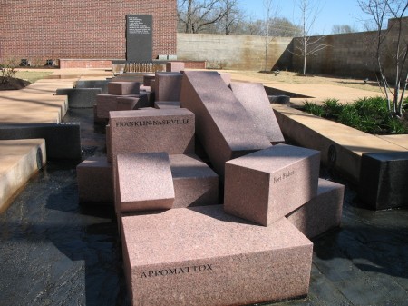
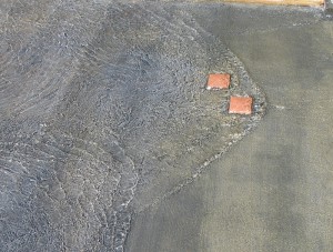
The most interesting part of the center is the Stream of American History which is a wonderful place to learn about metaphors. The stream starts with a fountain that overflows through 13 notches cut in the rim of the basin into a shallow water course that gradually widens as more states are added to the U.S. In the first reach of the stream there are impediments in the paved stream bed that create turbulence, harbingers of the war to come (they create nice standing waves which is an additional point in their benefit).

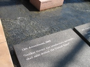
The 13th Amendment.

When the stream gets to its main focus, the civil war, large granitic blocks, cut into prisms and labeled with the names of the battles, break the stream into two before it finally merges again as it reaches the reflecting pool.

I threw my students at the Stream without telling them what it was. The only hint I gave was that it was a “large metaphor”. There were enough clues that they could figure it out. They wandered around it individually, with their pencils and notepaper for 15 minutes (I required that they write down their interpretation, then we got them together to pool their thoughts.

The stream is a very nice puzzle, and the National Park Service has a good key (pdf). It was a good way to end our immersion trip, and it gave the students something to think about on the long drive home.

[googleMap name=”Corinth Civil War Interpretive Center” width=”400″ height=”350″ mapzoom=”4″ mousewheel=”false” directions_to=”false”]501 West Linden Street, Corinth, MS‎[/googleMap]

Shiloh (and the battle of)

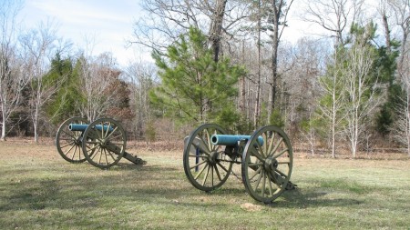
We hiked in Shiloh on a beautiful spring day just about a week before the anniversary of that formative battle of the American civil war. Trail #4 traces the battle from the first contact of union and confederate pickets near what is now Ed Shaws Store and Peach Orchard Restaurant, all the way to the park center where General Grant formed his last line of defense.

[googleMap name=”Ed Shaws Store” description=”Start of Trail #4″ width=”400″ height=”400″ mapzoom=”13″ mousewheel=”false”]35.116, -88.362[/googleMap]

The hike winds its way across mowed fields and through rolling, forested tracts. With the leaves not yet on the trees this was the perfect time to make this hike. Two years ago, the last time the middle school did this trip, they did it a little earlier in the year in below-freezing temperatures. Apparently it was great for character building.

We weren’t quite as lucky in the character building department, it was a nice clear day, not too hot and not too cold. On the five mile hike and our students got a lot of practice navigating by compass. However, we had to take to the paved roads about a third of the way through in order to have lunch before meeting park ranger Paul Holloway for a demonstration of an infantryman.

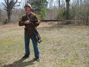
Paul Holloway about to charge.

Mr. Holloway was superb, bringing into sharp relief the similarities and contrasts between soldiers in the two armies. He wore a brown coat, colors which could have been on either side, and demonstrated a rifle which was impressively loud, smokey and heavy.

Before sitting beneath a tree for our class discussion of what we saw that day we took in the visitor center and the movie, made in 1956, about the Battle of Shiloh. I though the movie was quite informative if a bit understaffed, but my students picked up on the fact that the amateur thespians kept stealing glances at the camera. Not to mention getting up and charging again after they’d been shot. They also detected a subtle bias toward the South from the narrator and in the content of the movie.

The rifle demonstration was extremely useful in setting the stage for the movie, but I though the five mile hike was also important because the students got the chance to feel the distance and then consider that what took us a couple of hours, took an entire day of hard fighting.

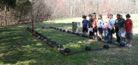
Confederate mass grave.

Pickwick Landing Hydroelectric Dam

[googleMap name=”Old Turbine” description=”Pickwick Landing Hydroelectric Dam” width=”490″ height=”490″ mapzoom=”14″ mousewheel=”false”]35.072711, -88.250578[/googleMap]

The hydroelectric dam at Pickwick Landing on the Tennessee River is an almost ideal place to observe electricity generation and transmission. It was a serendipitous discovery though. After our failure to arrange a tour of a dam in Arkansas on the last immersion, we did not even try with this one.

The dam is right next to Pickwick Landing State Park where we camp when visiting the Shiloh National Battlefield. We’d arrived early at the park on the day before our visit to Shiloh, and having seen the dam and its locks on Google Maps’ satellite image (click the satellite button on the map above), I thought it might be useful if we drove over.

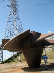
Turbine for hydroelectric dam. High voltage power lines in the background.

Coming around the northern side of the dam we spotted, right next to a parking lot, an old turbine from the dam that had been set up for display. It is amazing how big these things are, but what was really neat is the fact that if you listened, you could hear the whine of the modern turbines coming from the generators deep inside the dam.

Standing over the old turbine was an enormous high-voltage wire tower, sparse metal frame and truncated arms like a benevolent grandparent leaning over a plump, but scared child. The line of towers are connected to the generation station in the dam by power substation just across the street from the old turbine. The substation’s large transformer drums were obvious even from across the road.

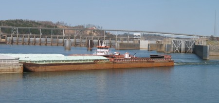
Crossing southward over the dam, there is a road that runs westward along the edge of the river that allows a good view of the downriver side of the locks. We were lucky enough to see a barge passing through, although with the traffic on the river the locks are probably always busy.

Barge exiting the lock.

When we got back to the park the students draw a diagrams of the dam. They don’t do nearly enough diagrams given the importance of drawing in connecting the body and the mind (something I plan on rectifying in the next cycle) so this was a good experience for them. It was also a reminder to always keep their writer’s notebooks with them because then they could have drawn their diagram while they were at the dam looking at the thing.

PBS’s Exploring History in Corinth and Shiloh

Exploring History video at the website of PBS station KLRU

Since we just got back from an immersion trip to Corinth, MS and Shiloh, it was very interesting to find out the PBS has a new Exploring history program: Exploring History: Corinth, Mississippi and Shiloh National Military Park. Check your local station (as they say) or you can find the video online.

Fossils at Pickwick Landing

Paleozoic (250-550 million years ago) fossils.

Along the edge of Pickwick Lake are outcrops of sedimentary rock being slowly broken apart by the action of the waves on the reservoir. We stopped for lunch at Shelter #6 in Pickwick Landing State Park (see map) before finding our cabins for this immersion. Located at the eastern edge of a triangular ridge of land girded by drowned river valleys on two sides the shelter is almost surrounded by water. On a beautiful, clear day at the beginning of spring, with temperatures verging on t-shirt weather, tiny flowers blooming in the grass and tree leaves just sprouting, it was an almost perfect time and place to take a break after a long drive.

Shelter #6.

Yet despite the fact that we were eating later that we normally do, half the class walked right past the shelter and down the rough slope to the lake’s edge. There they found fossils. Beautiful crinoids were weathering out of thin (4cm thick) alternating layers of sandstone and limestone, their long fossilized necks resisting while the limestone around them slowly dissolved away. They also found bivalves partially exposed on the face of the broken cliff and in the small pile of tallus. There were even a few thin sandstone wedges sitting on the rocks at the edge of the water that looked like fossilized burrow molds. It was quite fascinating.

View from inside the shelter.

Neither the word “science” nor the phrase “natural world” was used, and they brought the questions to me, which I always consider better than me asking them. Next year when we study Earth History perhaps the subject will be considered boring when we see it in the classroom, but today, out there on the rocks at the edge of the water, they got a great primer.

This stop, planed solely as a lunch break was so successful that I now wonder if I should plan the immersion trips to introduce the topics we cover in class rather than using them to integrate what we’ve already seen. Let the outdoor experience be the “spark the imagination” part of the lesson. I’m not sure, but it’s something to think about.

[googleMap name=”Picnic Shelter #6, Pickwick Landing State Park” description=”The picnic shelter is located at the point due west of this marker.” width=”480″ height=”400″ mapzoom=”15″ mousewheel=”false”]35.055555, -88.232[/googleMap]