Longshore Drift and Pufferfish

A groin strains to hold back the longshore drift. It is, as always, only partially successful.

It was about 1.5 kilometers from the Research Lab to the estuary where we spent our first morning sampling (overview of the trip is here).
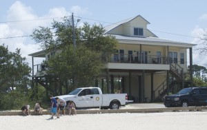
Elevated beach house.

Walking along the beach to get there, we could see the beach houses to the right of us, across the narrow road of East Beach Drive, standing tall on columns to keep them above the reach of the storms. According to Stephanie, our guide, the storm surge from Hurricane Katrina in 2005, reached awfully close to the tops of the columns. The research lab, which is not elevated, lost an entire building to that hurricane. Indeed, much of the coast is still recovering from Katrina’s damage.

The white sandy beach, on the other hand, looked beautiful, which was a bit odd. After all, how did it survive the storm? Furthermore, when you think about it, this beach is located behind a string of barrier islands, which protect the coast from the full force of the waves coming out of the Gulf of Mexico, so how come there is enough wave energy to maintain a sandy beach. The relatively calm waters should allow finer grained sediment, like clay and silt, to settle out, and this area really should be a marsh. The answer, it seems, is that this is an artificial beach. Every few years, thousands of tons of sand are dumped along the coast to “replenish” the beachs.
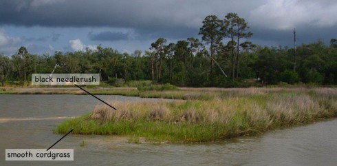
Without beach replenishment the beaches would revert to salt marshes like this one.

This coastline really should be a tidal marsh, like the one we found when we got to the estuary. These Gulf-coast salt-marshes are fronted by a relatively short version of smooth cordgrass (spartina alterniflora), backed up by the taller, and more common black needlerush (Juncus roemerianus Scheele) .

Longshore Drift

Now, if this is a low-energy environment that allows silt and clay can settle out of the water column, where does the sand go so that it has to be replenished every so often? It is gradually moved along the coast by longshore drift.
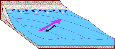
Longshore drift moves sand along the coast in the direction of the wind. Image via the USGS.

Waves hit the beach at an angle. As they break, the turbulent swash pushes sand up the beach at the same angle as the movement of the waves. As the wave retreats, the backwash, drawn by gravity, pulls sand perpendicularly down towards the water. The net effect, is that sand gradually moves down the coastline with each swash and backwash of the waves.

Since dumping tons of sand is expensive, engineers try other things to prevent the sand from running off down the beach. Someone, a very long time ago, had the great idea to build a wall sticking out from the beach to impede the sand in its unwanted migration. This type of wall is called a groin (or sometimes a groyne in polite company), and it does stop the sand. In fact, the sand builds up on the upwind side of the groin. Unfortunately, it does not stop the longshore drift on the downwind side, and that results in the erosion of a bay on that side.

A groin impedes longshore drift. Note that the waves approach the beach at an oblique angle.

Pufferfish

Beaches are also great places to find random things washing up. We lucked upon an unusually large pufferfish (family: tetraodontidae). It was quite puffed up. It was also quite dead.
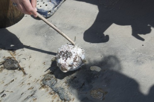
Pufferfish.

Pufferfish are famous for being extremely poisonous. According to the National Geographic page on pufferfish, their tetrodotoxin over a thousand times more poisonous than cyanide, and there is no known antidote.
Seining in the Sound

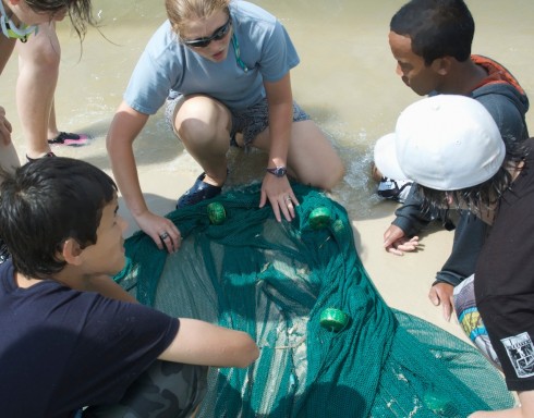
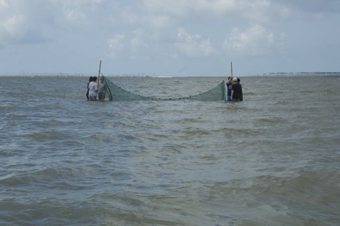
Setting up the seine.

After surface sampling with the dip nets, and subsurface sampling with the little corers, we tried sampling the water column using a small seine.

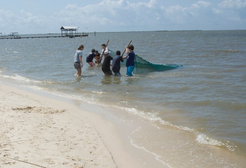
Seining requires teamwork, and I was pleased to see everyone working well together, focused on the job at hand.

Working together to bring in the catch.

Hauling on the nets, with the smell of salt in the air, resurrected long neglected memories of fishermen at work on tropical, Atlantic beaches. Back then they were going after fish for the market, here, with our much finer meshed net, we were looking for anything interesting in the water column.

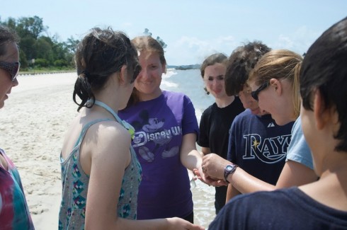
Examining the catch.

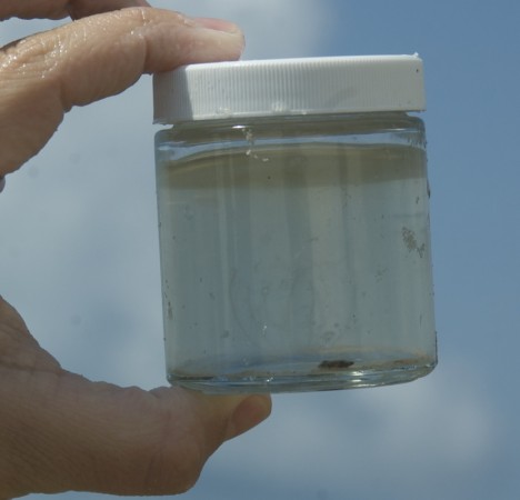
Everyone got touch a ctenophore (comb jelly), which I will note is not a jellyfish, and is also not poisonous.

If you look carefully you can just make out a comb jelly in the jar.

Students also had a chance to hold a croaker (a fish of the family Sciaenidae), and feel it croak.

Feeling the croak.

Our guide was great. She was quite knowledgeable about the fauna we ran into, and very good at sharing information.

Stephanie T. pointing out the finer points of piscine morphology.

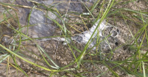
Interestingly, we were not the only ones out seining that morning. There was a small group from the research lab looking for skates for a research project. I think they said that this was their third time out looking, but like us, they did not find any elasmobranchs (not counting the one dead specimen we ran into while dip netting).

Remains of a skate, lying in the grass at the edge of the beach.

Dip Nets in the Estuary

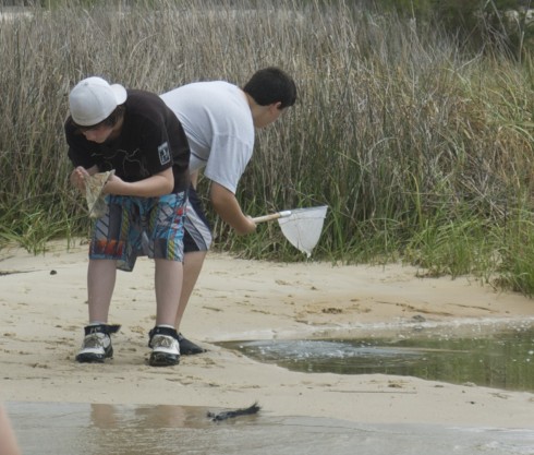
Dip nets in action.
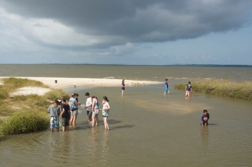
Sampling in the estuary.

Doing the “sting ray shuffle” through the shallow waters of the estuary of a small stream and the Mississippi Sound, we used dip nets to collect organisms from the sediment-water interface.

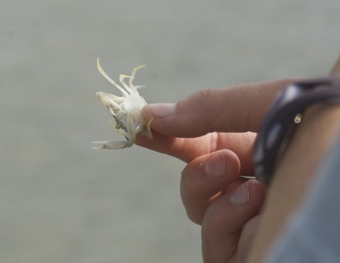
We found mostly invertebrates. There were lots of small white crabs. Most, but not all, were too small to pinch.

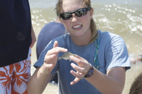
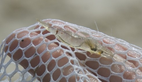
We also grabbed quite a number of translucent shrimp.

You can very clearly see the entire gastro-intestinal system of this small shrimp.

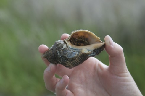
And there were a lot of hermit crabs.

An understandably shy hermit crab.

A couple students also picked up some small snakes, but they quickly slipped through the dip net’s mesh and escaped.

Simple and effective, dip netting was a nice way to start the Coastal Sciences Camp.

Coastal Science Camp at the Gulf Coast Research Lab

Dip netting in a small estuary.

As you may have guessed from the previous posts about waterspouts and the dolphin, we’ve been on the Gulf coast for the last few days. Specifically, we were visiting the Gulf Coast Research Lab‘s Marine Education Center for two days for our end-of-year trip.

It was excellent. The weather was perfect; sunny with lots of cumuliform clouds for shade but little rain. However, the what really made the trip work was that we had a good, interesting, and varied program, directed by an excellent instructor, Stephanie T..

Stephanie T. pointing out the finer points of piscine morphology.

For reference (to link all posts about the Coastal Science Camp):


View Coastal Sciences Camp, Gulf Coast Research Lab in a larger map

Dolphin

Dolphin in the boat's wake.

We weren’t looking for them at the time, and later when we were looking for them we didn’t find them, but on our trip back to the GCRL-MEC a dolphin decided it wanted to play in our boat’s wake.

It would jump through the face of the bow wave. Usually horizontally, but vertically once or twice.

Playing.

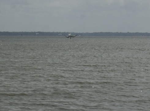
Dolphins usually travel in pods of up to a dozen or so individuals. This one, however, was alone. We’d seen it earlier, while we were walking on the beach and picking up trash. The dolphin may have been playing or eating, but it was certainly scaring the small fish. A couple birds took advantage of this to make their own catches, with near vertical dives into the gently rolling waters of the sound.

It was wonderful to observe.

Bird caught in the middle of a dive, just before it splashed into the water.

Waterspouts

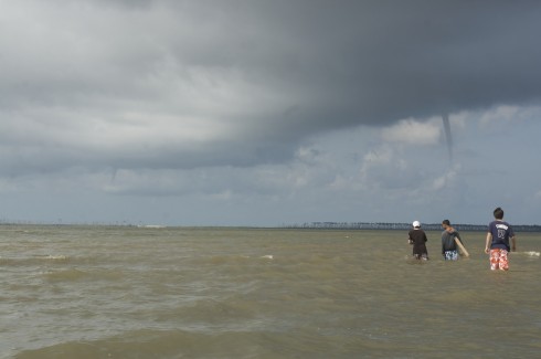
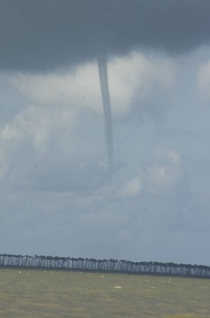
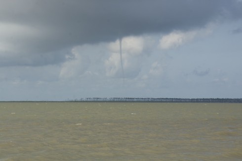
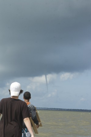
Two waterspouts seen over Ocean Springs.

As we waded through the Mississippi Sound, doing the Sting Ray Shuffle, sampling for benthic fauna, we came across these two waterspouts. Our guide, Stephanie, from the Gulf Coast Research Lab’s Marine Education Center, said they’re not that common.

Subtly sinuous.

They’re quite elegant.

In the distance.

Fortunately, they were very far away.

Fascinating.

Chasing Raindrops: A Hike in Natchez Trace State Park

In which we follow the path of a raindrop from the watershed’s divide to its estuary on the lake.

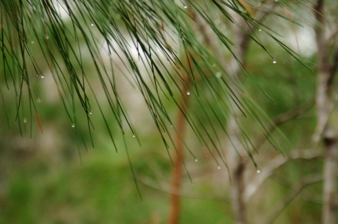
Droplets of water scintilate at the tips of pine needles. When they fall to the ground they continue their never-ending journey in the water cycle.

The most recent immersion. Coon Creek.

We stayed at Natchez Trace State Park and just a couple meters away from the villas is the head of the Oak Ridge Trail (detailed park map here).


View Natchez Trace Immersion Hike in a larger map

The first thing you notice is a small, rickety bridge whose main job is to keep your feet dry as you cross a very small stream. The stream is on its delta, so the ground is very soggy, and the channel is just about start its many bifurcations into distributaries that fan out and create the characteristic deltaic shape.

Delta and estuary of the small stream near the villas.

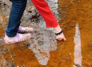
There’s a bright orange flocculate on the quieter parts of the stream bed. It’s the color of fresh rust, which leads me to suspect it’s some sort of iron precipitate.

It is quite easy to stick your finger into the red precipitate at the bottom of the stream.

Iron minerals in the sediments and bedrock of the watershed are dissolved by groundwater, but when that water discharges into the stream it becomes oxygenated as air mixes in. The dissolved iron reacts with the oxygen to create the fine orange precipitate. Sometimes, the chemical reaction is abiotic, other times it’s aided by bacteria (Kadlec and Wallace, 2009).

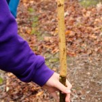
The bark has been chewed off the top half of this stick. The tooth marks are characteristic of beavers.

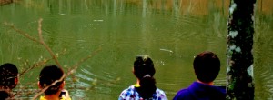
Past the small delta, the trail follows the lake as it curves around into another, much bigger estuary (see map above). We found much evidence of flora and fauna, including signs of beavers.

We even took the time to toss some sticks into the water to watch the waves. With a single stick, you can see the wave dissipate as it expands, much like I tried to model for the height of a tsunami. We also threw in multiple sticks to create interference patterns.

Observing interference patterns in waves.

The Oak Ridge Trail, which we followed, diverges from the somewhat longer Pin Oak Trail at the large estuary (which is marked on the map). The Pin Oak Trail takes you through some beautiful stands of conifers, offering the chance to talk about different ecological communities, but we did not have the time to see both trails.

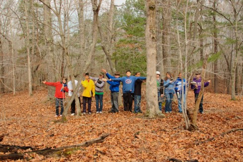
Instead, we followed the Oak Ridge Trail up the ridge (through one small stand of pines) until it met the road. The road is on the other side of the watershed divide. I emphasized the concept by having my students stand in a line across the divide and point in the direction of that a drop of water, rolling across the ground, would flow.

At the watershed divide.

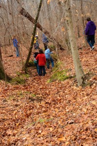
Then I told them that we’d get back by following our fictitious water droplet off the ridge into the valley. And we did, traipsing through the leaf-carpeted woods.

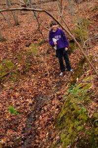
Students imitating water droplets find a dry gully.

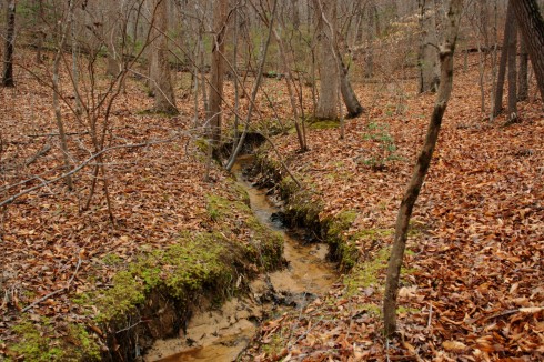
Of course there were no water droplets flowing across the surface. Unless its actively raining, water tends to sink down into the soil and flow through the ground until it gets to the bottom of the valley, where it emerges as springs. Even before you see the first spring, though, you can see the gullies carved by overland flow during storms.

Spring.

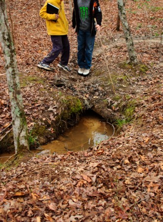
Following the small stream was quite enjoyable. It was small enough to jump across, and there were some places where the stream had bored short sections of tunnels beneath its bed.

The stream pipes beneath its bed. Jumping up and down over the pipe caused sediment to be expelled at the mouth of the tunnel.

I took the time to observe the beautiful moss that maintained the banks of the stream. Students took the time to observe the environment.

Taking a break at the confluence of two streams.

Downstream the valley got wider and wider, and the stream cut deeper and deeper into the valley floor, but even the small stream sought to meander back and forth, creating beautiful little point bars and cut-banks.

A small, meandering channel. Note the sandy point bars on the inside of the bend, and the overhanging cut-banks on the outside of the curve.

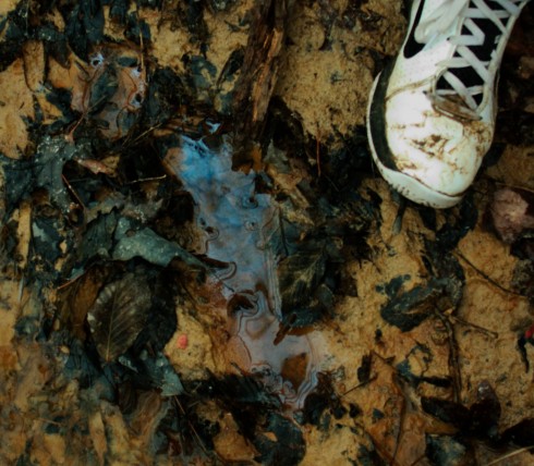
As the stream approached its estuary it would stagnate in places. There, buried leaves and organic matter would decay under the sediment and water in anoxic conditions, rendering their oils and producing natural gas. We’re going to be talking about global warming and the carbon cycle next week so I was quite enthused when students pointed out the sheen of oils glistening on isolated pools of stagnant water.

The breakdown of buried organic matter produces gas and oils that are less dense than water.

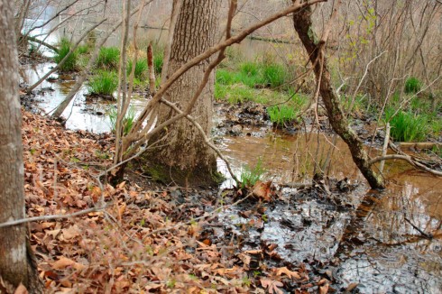
Finally, we returned to the estuary. It’s much larger than the first one we saw, and it’s flat, swampy with lots of distributaries, and chock full of the sediment and debris of the watershed above it.

View of the lake from the estuary. The red iron floc in the stream made for a beautiful contrast with the black of the decaying leaves. There is so much red precipitate that it is visible on the satellite image.

This less than three kilometer hike took the best part of two hours. But that’s pretty fast if you value your dawdling.

The Truth about the Hike in Montgomery Bell

Way back in Cycle 3, our class had our immersion to Nashville. We stayed in villas in Montgomery Bell State Park. Dr. mentioned in his post, “Limestone Trails at Montgomery Bell State Park”, that we went on a hike. It said that we followed a stream and then followed a ridge trail back to the villas, but it never said what happened in-between that. I’m gonna tell what really happened on that hiking day at Montgomery Bell State Park.

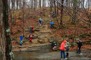
Our class did follow a stream; we did get soaked with nasty water; we were trying to learn something about the boring rocks that I don’t remember; and were trying to see who would fall in the stream the most.

Fellow classmates climbing over big, boring, rocks!

After a long time of following the creek (mainly walking in it), we got near a children’s play-area. Dr. told us that we needed to get back, but that we weren’t tracing our steps back. We had to climb over more huge, boring rocks to get to the ridge trail. Dr. then told us to just follow the path. Seven of us went up ahead while the rest of the class stayed way behind.

Meanwhile, one student was assigned to be the last one of the group. He got ahead of Dr., by a couple of paces, but kept looking back to make sure Dr. was following us. One time he looked back, he realized that our teacher was gone! He told two other students what had happened, and they, freaking out, ran up trying to catch up to the rest of the group. They found us and filled us in.

We all thought we were going to die out there: we were gonna be eaten alive by mountain lions; we were gonna starve; we were gonna die of thirst because we were all too stupid to go back to the stream for water! We were all going to die no matter what, unless we found Dr. We didn’t know what to do.

Some of the so-called, “adventurous”, students ran back to find Dr., while one student continued to follow the trail. The rest of us just stayed put.

The group who ran back found Dr., dilly-dallying, while the group who stayed put tried to find the one student who’d ran up ahead of the main group. Soon enough, we were happy to see Dr. again (well some of us were), because we were tired of looking for where we had to go. The first thing I heard from him was, “You guys shouldn’t have wandered off.”

It wasn’t our fault that we didn’t know where Dr. was. He was busy taking pictures so the rest of us went up ahead. Because of this, we could have died. We didn’t know where to go. He should be in front, so we know where to go and so we don’t die. It was all of his fault not ours.

He didn’t believe that.