Last year, for an IRP, one of my students did the experiment measuring the speed of light (and the wavelength of the waves) using marshmellows in a microwave. The video above (via Gizmodo) shows the pattern of the microwaves using some neon lights embedded in plastic. The video below, from MythBusters, shows superheated water in action; something I demo every time I make tea-water in the microwave.
Category: Natural World
Life on Mars
Discover Magazine has a great article summarizing the evidence for life on Mars. It’s long because it goes into a lot of detail examines quite a variety of possibilities, but it ties quite nicely in with the questions we are asking about what is life and where it can be found.
The article also mentions a study titled, “The Limits of Organic Life in Planetary Systems” produced by the National Research Council for NASA. It can be found for free online, with an associated podcast that much more accessible to middle schoolers. The report is extremely open to the possibility that extra-terrestrial life exists, and could exist even without water and might even be silicon based.
Artistic satellite views of the Earth
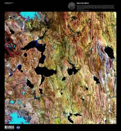
For the geography nerds, but perhaps also for those with an appreciation of the natural beauty of the world. The US Geological Survey has a series of satellite pictures chosen just for their sheer beauty.
The Landsat satellites that take these pictures usually photograph in more than just the human-visible color spectrum. For many geologic and environmental purposes, different infra-red wavelengths are often better for seeing details on the Earth’s surface. The USGS has a nice primer on the Landsat program. Many of the color images posted here were reconstructed from different color bands.
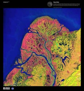
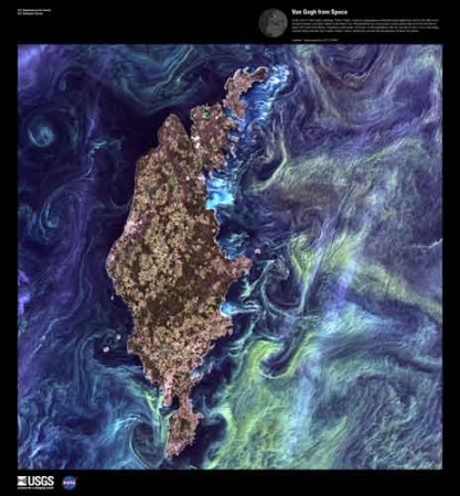
The resulting images can be exceptionally beautiful and somewhat surreal. I like that there is an abstract surface beauty, divorced from the content, meaning and understanding that a closer analysis of the images yields to the eye of the trained observer: delicate swirls of algae might be signs of eutrophication to a biologist; dendritic deltas tell the geologist about sediment load, offshore currents and mass balance.
Environmental imperatives
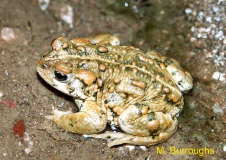
NPR had facinating story recently about unlikely groups working together. It’s about a town in Nevada that banded together to save a toad from going extinct. The groups working together include environmentalists and the Saving Toads thru Off-Road Racing, Mining and Ranching in Oasis Valley (aka STORM-OV).
Extraterrestrials: Exploring space for signs of life
Intelligent Life
One of the major motivations space exploration is the search for extra-terrestrial life. The SETI project is the most visible initiative and there are a lot of neat educational resources on their outreach page. And you can participate. seti@home allows you to download a screensaver that actually helps them process data.
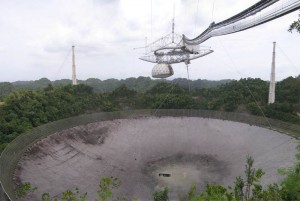
The NPR program, To the Best of Our Knowledge, has a nice program asking the question, “What is Life?” The last part of the program (at about 45:00 minutes in) is an interview with Paul Davies who is head of the SETI post-detection task group. It starts with question of silicon based life, the theory of which is based on the locations of carbon and silicon in the same column in the periodic table. It also talks about what life might look like once technology really takes off and life starts “evolving by design”.
Finding life as we know it
But SETI searches for signs of intelligent life using radiotelescopes. There are other projects that look for any sign of live. One of the major reasons the Mars rovers and satellites spend a lot of time looking for signs of water on the planet is that life, as we know it, requires water.
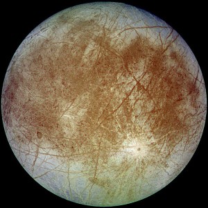
It’s also why space agencies are so interest in Europa, the moon of Jupiter that’s covered with ice. Europa also has signs of volcanic activity under the ice, which makes it doubly interesting.
Powers of Ten online
The Powers of Ten video, which we use in the lesson on modern exploration is now online.
The Powers of Ten website also has a nice little interactive illustration that shows all the different scales.
Mariner AO: Discovering the Americas
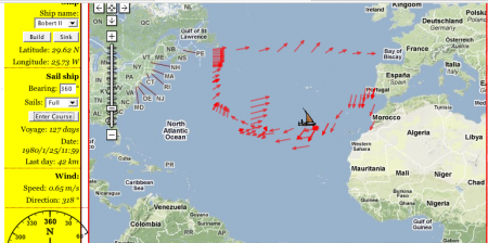
We just used my sailing game, Mariner AO, to help wrap up the group presentations on the European exploration of the Americas, and it worked wonderfully!
The small groups did their presentations timewise, starting with the Vikings (don’t ask me about Leprechauns), then the Spanish, the French (don’t ask me about giant sharks and flying pigs), and finally the English. At the end, we had half an hour left, but instead of just tying it together with a graphic organizer, I wanted to show them Mariner AO because the North Atlantic wind circulation ties in so wonderfully well with the pattern of colonization.
I started trying to show it off as a group, having them tell me which direction to sail the ship to get to the Americas. As you could probably predict that didn’t work particularly well. Everyone was yelling out directions at cross-purposes; however, it did give me the chance to show them all how the game worked.
Even with all the confusion the group seemed to like the game. Someone even suggested, “Why didn’t we do this for group work.” And I though, “Why not?” So the class broke apart for 25 minutes to see who could discover America first.
There was a lot of excitement in the room. I offered them extra points for the team that reached America first. They all know how empty that reward is by now so I think most of the excitement really came from being able to play a game with a little bit of competition.
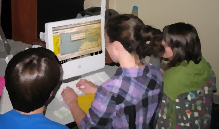
The website still has a few bugs, especially on our older computers, but it worked. Three of the four groups reached the Americas, though two of them landed on the Canadian coast. The third group may well have ended up there as well, but I dropped a hint about Columbus’ route that sent them sailing into the Caribbean.
At least two kids planned on trying it at home. I had to pry one of the groups away from the computer so they could get their end-of-the-day jobs done on time.
We took screen captures of routes they took, and tomorrow we’ll put it all together, talk about the trade winds, what Columbus knew, and why the Iberians colonized South America while the French and English ended up mostly in the North.
First frost
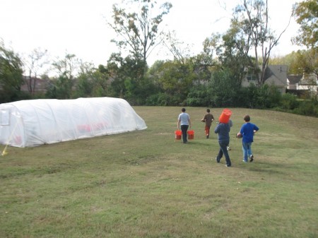
The temperature dropped below zero (Celcius) for the first time last Friday night. We’d put back up the greenhouse’s plastic cover, which had blown off a couple weeks ago in a wind storm, but that was not enough to save a couple tomatoes and a squash plant.
It was a good illustration of the effects of freezing on plants not adapted to the colder weather. The leaves all turned black and flopped over, probably because the expanding ice ruptured the cell walls.
It also indicates that I need to get at temperature data-logger so I can monitor the temperature inside and outside the greenhouse. In the spring I hope to start a bunch of plants inside but put them into the greenhouse at the first opportunity, but I’ll need to make sure that greenhouse can support them. The data logger will also allow for some interesting experiments.