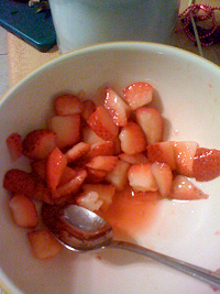
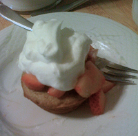
Osmosis is the movement of liquids through a membrane, from areas of high to regions of low concentration. So, if you sprinkle sugar onto ripe strawberries, the concentration of sugar on the outside of the berries becomes very high. The juices will seep out of the strawberries’ cells, through the cell walls (the membrane), and create quite the delectable syrup. Add a few shortcakes and some whipped cream and ….
Note to self: try strawberries in the greenhouse this winter. Life sciences are next year and osmosis is a key concept.
Note #2: This is also a large part of the answer to the question of, “Why do we get thirsty when we eat salty foods?”
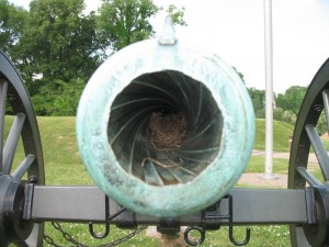
Four hours away, Vicksburg, MS. is just within reach for an immersion trip so, since we were in the area, I scoped it out for a future trip. Vicksburg was the final town to fall before the Union could control the Mississippi River and split the Confederacy into two, so it’s historically important. The Vicksburg National Military Park is chock full of monuments and markers that give a good idea about the chaos and carnage of the battle for the town, and even a chance to observe practical application of simple machines and steam engines.
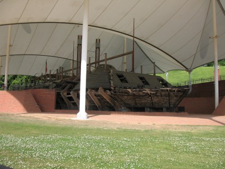
The park could complement Shiloh and Corinth quite nicely since Vicksburg’s importance was because of its control of transportation routes, just like with Corinth. It also has the salvage of the USS Cairo, an ironclad sunk during the Civil War. Much of he Hull is still missing so it’s a wonderful chance to see all the mechanisms and engines in a steam powered ship.
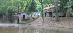
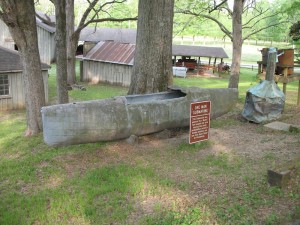
What I found most interesting, however, were the old watermill and farming equipment at Grand Gulf Military Park, about 45 minutes south of Vicksburg. They seem almost in working order, and if you’ve been discussing simple machines, as we have, it’s a great opportunity to see how they were applied in real-life.
The watermill is quite picturesque, making it a great subject for sketching or drawing. I like to combine art and science in this way when possible. Grand Gulf also has a small, submarine used by bootleggers during prohibition which is quite the curious piece of engineering.
[googleMap name=”Grand Gulf Military State Park” description=”Watermill and camping” width=”400″ height=”300″ mapzoom=”8″ mousewheel=”false”]12006 Grand Gulf Rd, Port Gibson, MS[/googleMap]
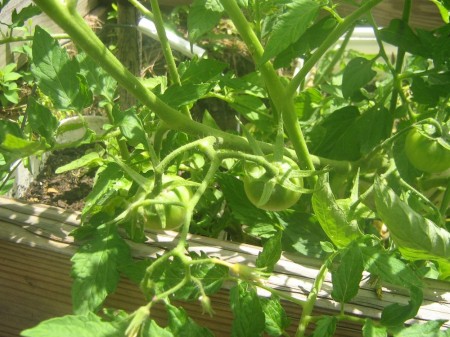
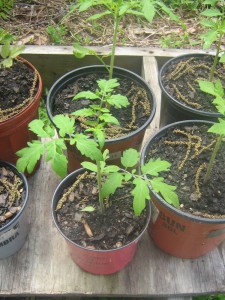
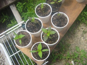
Next year we’ll be focusing on the life sciences, so this year one of my student’s research project was to try to grow some plants using the system we’d set up the year before to see how effective it was and to find out if we could use the plants we grow for a plant sale at the end of the year. I also started some plants at home as did the student’s parents, which served as a reasonable control.
We learned that you have to account for the different germination times for different plants, and the importance of hardening plants off before taking them outside. We also learned that the greenhouse can get too warm in the spring. While the plants we started at school were not the most successful, it was an extremely useful project nonetheless, otherwise we’d probably have made the same mistakes next year. A pair of temperature/humidity data loggers, for inside and outside the greenhouse, will be extremely useful for monitoring growing conditions.
The big land-grant universities have fairly good extension services that have a lot of good information online. The University of Missouri’s page on Starting Plants From Seeds is quite useful, although it is not aimed at the organic gardener.
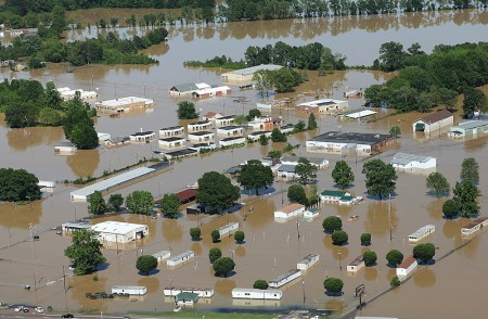
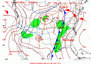
Over 30 cm of rainfall in just two days resulted in extensive flooding in Nashville, TN, last week. The precipitation was produced by one of those typical mid-latitude cyclones that sweep across the United States, from west to east, every spring and fall. The Boston Globe has some amazing picture of the flooding.
The news media tends to have the most dramatic photographs of disasters, but the Federal Emergency Management Agency (FEMA) also tends to have good images from their aerial surveys (like the image at the top of this post). And images produced by the government are in the public domain so you don’t have to worry about using them.
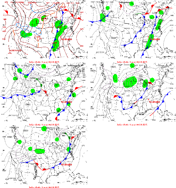
For discussing warm fronts, cold fronts and mid-latitude cyclones, NOAA‘s Hydrometeorological Prediction Center (HPC) is a great resource. You can find an archive of daily weather maps for the U.S. that you can click through to see the fronts move.
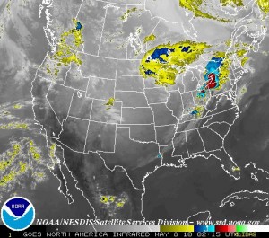
Satellite imagery usually complements to the frontal weather maps very well. Most satellites orbit around the Earth pretty quickly, at just the right orbital speed that the centrifugal force just balances the Earth’s gravity so the satellite does not crash into the atmosphere or escape into space. Some satellites are set into orbit a bit further out so that they can rotate with the Earth, effectively staying above the same place all the time. NOAA has a few of these geostationary satellites monitoring the weather around the world, and you can get real-time images from the Geostationary Satellite Server. There used to be archived satellite images but I can’t seem to find them at the moment.
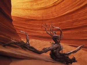
According to the Guardian, the Franklin River image was instrumental in preventing the flooding of the river for an hydroelectric dam. The Stone Canyon picture was used to try to have the area declared a national monument. I particularly appreciate the effort of Jack Dykinga, who took the Stone Canyon photo. He hiked up the slot canyon at 3:30 am in order to get the photograph at dawn; with their softer light and reddish tints, sunrise and sunset are the best times for photography.
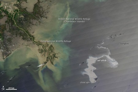
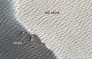
The scale of the disaster caused by the oil leaking into the Gulf of Mexico from the damaged oil rig is increasing day by day. We are preparing to go on the end-of-year adventure trip soon, but I’m wondering if students might be interested in heading down to the Gulf coast to volunteer in the clean-up.
NASA’s Earth Observatory has some amazing imagery on its page on the oil leak. Many of the images also show the mouth of the Mississippi and its delta, which tie directly into our observations in the sandbox. The impact of the oil spill also brings up the topic of density differences in fluids, something we’ve seen in the making bread jars, but applied to a much larger scale.
Science is, at its core, hypothesis testing. To learn science learn the scientific method: figure out the precise question to solve (as best you can); come up with an answer you think might work (hypothesis); test it; and repeat as necessary while modifying the hypothesis. Almost all science experiments for middle school through college involve following a set of instructions in the lab manual. Only in independent research projects do students actually go through the scientific process and then it’s difficult because they don’t have the experience.
Part of the problem is that it takes time. Time to muddle through the though process of trying to figure out what exactly is a tractable question to solve. Time to come up to with a reasonable, testable hypothesis. Time to figure out how to test it. Time for iterating through the process again, although, once you’ve set up your experiment the first time doing it again and again is not that hard or time-consuming.
With our Montessori Middle School’s six-week cycle of work, and even with the two weeks dedicated to the Natural World, students should be possible to get through this process for at least one problem. They would probably have to dedicate the two weeks to a single problem/experiment and it would probably be terribly slow in the beginning.
To discover the truth about nature, Ibn a-Haitham reasoned, one had to eliminate human opinion and allow the universe to speak for itself through physical experiments. “The seeker after truth is not one who studies the writings of the ancients and, following his natural disposition, puts his trust in them,” the first scientist wrote, “but rather the one who suspects his faith in them and questions what he gathers from them, the one who submits to argument and demonstration.” – Steffens (2008) (Ibn Al-Haytham: First Scientist)