Vietnam in pictures

American Marine in Da Nang, Vietnam, August 3, 1965. (Image from the U.S. Marine Corps.)

A slew of ideas and conflicts swirl around the Vietnam War: democracy, communism, dictatorship, freedom, colonialism, domino theory, chemical warfare, technology …. We’re supposed to look at wars through the lens of the “Characteristics of War”, but what do offense and defense mean in a war like Vietnam? A close examination of any of these words in the face of Vietnam leaves more questions than answers. The Boston Globe has a heartbreaking collection of images from the Vietnam War that give a remarkably multifaceted view of the conflict and its consequences. The photos are iconic and some are graphic.

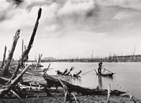
A guerrilla in the Mekong Delta paddles through a mangrove forest defoliated by Agent Orange (1970). Photograph by Le Minh Truong © National Geographic Society (from the International Center for Photography).

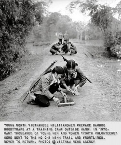
The photographs in the Boston Globe were mostly taken by western photographers (some were from the U.S. military), whose journalistic culture inspired them to try to capture all aspects of the war, to tell the whole story, independent of their own allegiance. There were fewer North Vietnamese photographers and their job was to capture images that would promote their side of the war. Even so, some of their photographs are also amazing and offer another perspective.

Photograph taken by a North Vietnamese war photographer (from SmugMug).

National Geographic collected some of these photos in Another Vietnam: Pictures of the War from the Other Side. More photos are available from SnugMug.com, and National Geographic has a documentary on North Vietnamese photographers called, Vietnam – The Unseen War (a 5 minute preview is available on VEOH).

These images help tell the story of how powerful the media can be, particularly in a democracy. What’s also interesting is the youth of many of the combatants on both sides.

[googleMap name=”Vietnam” width=”490″ height=”350″ mapzoom=”4″ mousewheel=”false” directions_to=”false”]Vietnam[/googleMap]

Cattle drives

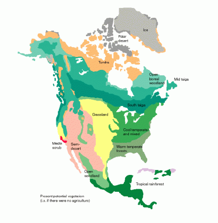
pre-European vegetation of the U.S. (from Oak Ridge National Laboratory).

The story of cattle drives and the railroads also has a lot to do with the geography of natural resources in the United States. A few good references:

Learning science

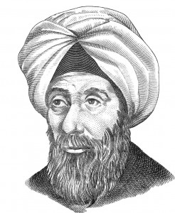
al-Hassan Ibn al-Haytham (b. 965-1039) (Image from Wikipedia)

Science is, at its core, hypothesis testing. To learn science learn the scientific method: figure out the precise question to solve (as best you can); come up with an answer you think might work (hypothesis); test it; and repeat as necessary while modifying the hypothesis. Almost all science experiments for middle school through college involve following a set of instructions in the lab manual. Only in independent research projects do students actually go through the scientific process and then it’s difficult because they don’t have the experience.

Part of the problem is that it takes time. Time to muddle through the though process of trying to figure out what exactly is a tractable question to solve. Time to come up to with a reasonable, testable hypothesis. Time to figure out how to test it. Time for iterating through the process again, although, once you’ve set up your experiment the first time doing it again and again is not that hard or time-consuming.

With our Montessori Middle School’s six-week cycle of work, and even with the two weeks dedicated to the Natural World, students should be possible to get through this process for at least one problem. They would probably have to dedicate the two weeks to a single problem/experiment and it would probably be terribly slow in the beginning.

To discover the truth about nature, Ibn a-Haitham reasoned, one had to eliminate human opinion and allow the universe to speak for itself through physical experiments. “The seeker after truth is not one who studies the writings of the ancients and, following his natural disposition, puts his trust in them,” the first scientist wrote, “but rather the one who suspects his faith in them and questions what he gathers from them, the one who submits to argument and demonstration.” – Steffens (2008) (Ibn Al-Haytham: First Scientist)

Corinth Mississippi in the Civil War

Stream of American History at the Corinth Civil War Interpretive center.

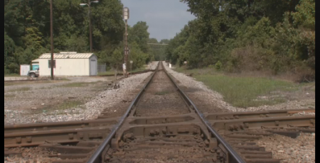
The Memphis to Charleston line was the only railroad that linked the East Coast of the Confederacy to the fertile Mississippi River Valley. At a time when the fastest way to move troops, supplies and commerce was by river or rail, the Memphis and Charleston railroad was essential (this was well noted in Robert Black’s “The Railroads of the Confederacy”). Cutting the railroad was an important objective of the Union. Cutting it at Corinth Mississippi would also cut the Mobile and Ohio Railroad line which linked the north and south of the Confederacy. Thus the Battle of Shiloh, where the Union could disembark its armies using the Tennessee River, and soon after, the Battle of Corinth.

The Civil War Interpretive Center in Corinth (this is also a good reference) does a nice job of presenting the details of the battles for the town, and their video presentation, with different images projected on multiple screens in a circular room was quite good (though there was a lot of information and you did not know quite which screen to focus on, so some students had trouble keeping track of it all).

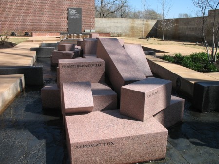
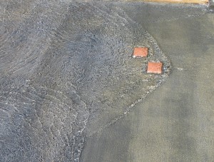
Standing waves: turbulence in the stream of American history.

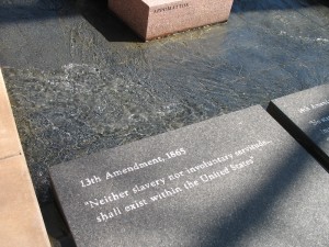
The most interesting part of the center is the Stream of American History which is a wonderful place to learn about metaphors. The stream starts with a fountain that overflows through 13 notches cut in the rim of the basin into a shallow water course that gradually widens as more states are added to the U.S. In the first reach of the stream there are impediments in the paved stream bed that create turbulence, harbingers of the war to come (they create nice standing waves which is an additional point in their benefit).

The 13th Amendment.

When the stream gets to its main focus, the civil war, large granitic blocks, cut into prisms and labeled with the names of the battles, break the stream into two before it finally merges again as it reaches the reflecting pool.

I threw my students at the Stream without telling them what it was. The only hint I gave was that it was a “large metaphor”. There were enough clues that they could figure it out. They wandered around it individually, with their pencils and notepaper for 15 minutes (I required that they write down their interpretation, then we got them together to pool their thoughts.

The stream is a very nice puzzle, and the National Park Service has a good key (pdf). It was a good way to end our immersion trip, and it gave the students something to think about on the long drive home.

[googleMap name=”Corinth Civil War Interpretive Center” width=”400″ height=”350″ mapzoom=”4″ mousewheel=”false” directions_to=”false”]501 West Linden Street, Corinth, MS‎[/googleMap]

Shiloh (and the battle of)

We hiked in Shiloh on a beautiful spring day just about a week before the anniversary of that formative battle of the American civil war. Trail #4 traces the battle from the first contact of union and confederate pickets near what is now Ed Shaws Store and Peach Orchard Restaurant, all the way to the park center where General Grant formed his last line of defense.

[googleMap name=”Ed Shaws Store” description=”Start of Trail #4″ width=”400″ height=”400″ mapzoom=”13″ mousewheel=”false”]35.116, -88.362[/googleMap]

The hike winds its way across mowed fields and through rolling, forested tracts. With the leaves not yet on the trees this was the perfect time to make this hike. Two years ago, the last time the middle school did this trip, they did it a little earlier in the year in below-freezing temperatures. Apparently it was great for character building.

We weren’t quite as lucky in the character building department, it was a nice clear day, not too hot and not too cold. On the five mile hike and our students got a lot of practice navigating by compass. However, we had to take to the paved roads about a third of the way through in order to have lunch before meeting park ranger Paul Holloway for a demonstration of an infantryman.

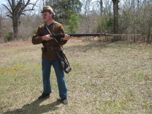
Paul Holloway about to charge.

Mr. Holloway was superb, bringing into sharp relief the similarities and contrasts between soldiers in the two armies. He wore a brown coat, colors which could have been on either side, and demonstrated a rifle which was impressively loud, smokey and heavy.

Before sitting beneath a tree for our class discussion of what we saw that day we took in the visitor center and the movie, made in 1956, about the Battle of Shiloh. I though the movie was quite informative if a bit understaffed, but my students picked up on the fact that the amateur thespians kept stealing glances at the camera. Not to mention getting up and charging again after they’d been shot. They also detected a subtle bias toward the South from the narrator and in the content of the movie.

The rifle demonstration was extremely useful in setting the stage for the movie, but I though the five mile hike was also important because the students got the chance to feel the distance and then consider that what took us a couple of hours, took an entire day of hard fighting.

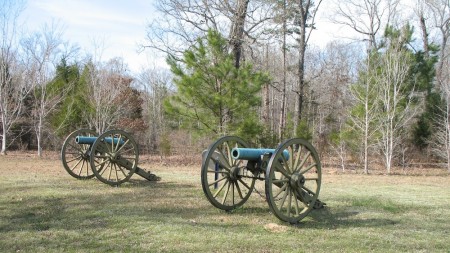
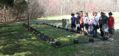
Confederate mass grave.

PBS’s Exploring History in Corinth and Shiloh

Exploring History video at the website of PBS station KLRU

Since we just got back from an immersion trip to Corinth, MS and Shiloh, it was very interesting to find out the PBS has a new Exploring history program: Exploring History: Corinth, Mississippi and Shiloh National Military Park. Check your local station (as they say) or you can find the video online.

Blogging the industrial revolution

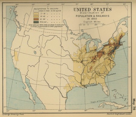
Map of population and railroads in 1850 (from Emerson Kent.com)

Not for the faint of heart, but interesting non-the-less, the Economic History blog has a nice series of posts on articles studying the Industrial Revolution.

This blog summarizes papers published on Economic History in major academic journals. The industrial revolution series includes an interesting post on why the industrial revolution happened in the North and not the South. An article by Earle and Ronald (1980) argues that it was because of the monoculture agriculture (just one crop) in the north, cheap labour was available for industry.

Effect of racial and gender discrimination today

Wealth and race in the U.S.. From Chang (2010).

The legacy of racial and gender discrimination persists (like segregated proms in Mississippi). Attitudes are, slowly changing over the course of generations, but it’s a really slow change. Even today, men make more than women for doing the same jobs. Mariko Chang’s recent paper on the wealth gap between black women and everyone else, has some fascinating statistics and graphs showing the current disparities in income (how much money people make) and wealth (how much stuff they have (assets minus their debts)).

An interesting question for students to consider after looking at the graph is why exactly are there these disparities. This may also be a good focus for a Socratic Dialogue.