We weren’t looking for them at the time, and later when we were looking for them we didn’t find them, but on our trip back to the GCRL-MEC a dolphin decided it wanted to play in our boat’s wake.
It would jump through the face of the bow wave. Usually horizontally, but vertically once or twice.
Playing.
Dolphins usually travel in pods of up to a dozen or so individuals. This one, however, was alone. We’d seen it earlier, while we were walking on the beach and picking up trash. The dolphin may have been playing or eating, but it was certainly scaring the small fish. A couple birds took advantage of this to make their own catches, with near vertical dives into the gently rolling waters of the sound.
It was wonderful to observe.
Bird caught in the middle of a dive, just before it splashed into the water.
As we waded through the Mississippi Sound, doing the Sting Ray Shuffle, sampling for benthic fauna, we came across these two waterspouts. Our guide, Stephanie, from the Gulf Coast Research Lab’s Marine Education Center, said they’re not that common.
The first thing you notice is a small, rickety bridge whose main job is to keep your feet dry as you cross a very small stream. The stream is on its delta, so the ground is very soggy, and the channel is just about start its many bifurcations into distributaries that fan out and create the characteristic deltaic shape.
Delta and estuary of the small stream near the villas.
There’s a bright orange flocculate on the quieter parts of the stream bed. It’s the color of fresh rust, which leads me to suspect it’s some sort of iron precipitate.
It is quite easy to stick your finger into the red precipitate at the bottom of the stream.
Iron minerals in the sediments and bedrock of the watershed are dissolved by groundwater, but when that water discharges into the stream it becomes oxygenated as air mixes in. The dissolved iron reacts with the oxygen to create the fine orange precipitate. Sometimes, the chemical reaction is abiotic, other times it’s aided by bacteria (Kadlec and Wallace, 2009).
The bark has been chewed off the top half of this stick. The tooth marks are characteristic of beavers.
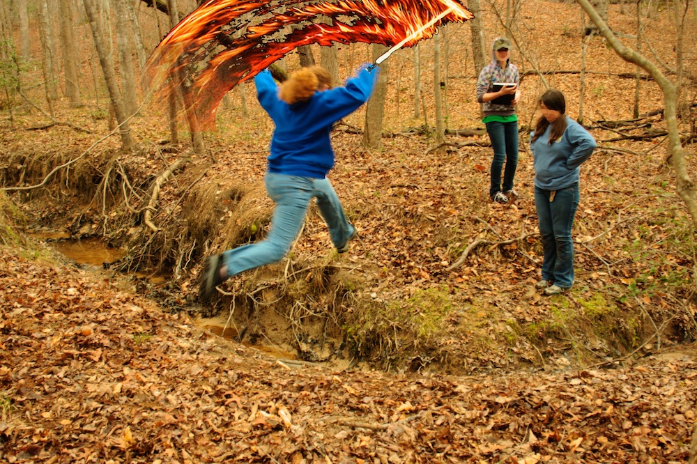
Past the small delta, the trail follows the lake as it curves around into another, much bigger estuary (see map above). We found much evidence of flora and fauna, including signs of beavers.
We even took the time to toss some sticks into the water to watch the waves. With a single stick, you can see the wave dissipate as it expands, much like I tried to model for the height of a tsunami. We also threw in multiple sticks to create interference patterns.
Observing interference patterns in waves.
The Oak Ridge Trail, which we followed, diverges from the somewhat longer Pin Oak Trail at the large estuary (which is marked on the map). The Pin Oak Trail takes you through some beautiful stands of conifers, offering the chance to talk about different ecological communities, but we did not have the time to see both trails.
Instead, we followed the Oak Ridge Trail up the ridge (through one small stand of pines) until it met the road. The road is on the other side of the watershed divide. I emphasized the concept by having my students stand in a line across the divide and point in the direction of that a drop of water, rolling across the ground, would flow.
At the watershed divide.
Then I told them that we’d get back by following our fictitious water droplet off the ridge into the valley. And we did, traipsing through the leaf-carpeted woods.
Students imitating water droplets find a dry gully.
Of course there were no water droplets flowing across the surface. Unless its actively raining, water tends to sink down into the soil and flow through the ground until it gets to the bottom of the valley, where it emerges as springs. Even before you see the first spring, though, you can see the gullies carved by overland flow during storms.
Spring.
Following the small stream was quite enjoyable. It was small enough to jump across, and there were some places where the stream had bored short sections of tunnels beneath its bed.
The stream pipes beneath its bed. Jumping up and down over the pipe caused sediment to be expelled at the mouth of the tunnel.
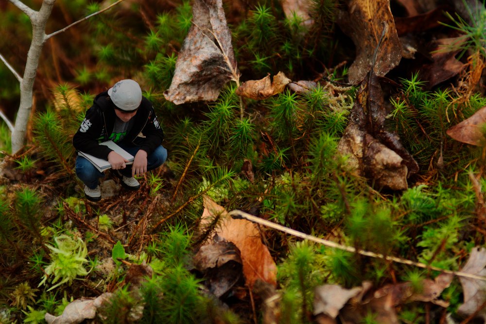
I took the time to observe the beautiful moss that maintained the banks of the stream. Students took the time to observe the environment.
Taking a break at the confluence of two streams.
Downstream the valley got wider and wider, and the stream cut deeper and deeper into the valley floor, but even the small stream sought to meander back and forth, creating beautiful little point bars and cut-banks.
A small, meandering channel. Note the sandy point bars on the inside of the bend, and the overhanging cut-banks on the outside of the curve.
As the stream approached its estuary it would stagnate in places. There, buried leaves and organic matter would decay under the sediment and water in anoxic conditions, rendering their oils and producing natural gas. We’re going to be talking about global warming and the carbon cycle next week so I was quite enthused when students pointed out the sheen of oils glistening on isolated pools of stagnant water.
The breakdown of buried organic matter produces gas and oils that are less dense than water.
Finally, we returned to the estuary. It’s much larger than the first one we saw, and it’s flat, swampy with lots of distributaries, and chock full of the sediment and debris of the watershed above it.
View of the lake from the estuary. The red iron floc in the stream made for a beautiful contrast with the black of the decaying leaves. There is so much red precipitate that it is visible on the satellite image.
This less than three kilometer hike took the best part of two hours. But that’s pretty fast if you value your dawdling.
Looking at the smear slides of Coon Creek Sediment Matrix got me thinking about just how important these little, microscopic shells have been for what we know about the Earth’s past climate. In fact, they provide the background knowledge that we have about the changes in climate that we’re seeing today.
Deep sea drilling vessel, JOIDES Resolution. Image via the National Science Foundation.
Back in the 1970’s the Deep Sea Drilling Project collected a lot of sediment cores from all around the world. The deeper you drill under the sea bed the older the sediments are, so micropaleontologists could look at how the organisms that lived in a certain area changed over time. Certain forams that could only live in warm oceans were found living far to the north. By combining all the information from all the sediment cores, they could construct paleo-geographic maps showing what the climate was like in the far past. It’s one of the reasons we know that the Jurassic climate was a lot warmer than today’s climate.
Then they invented mass spectrometers.
Mass specs can find the mass of individual atoms. Calcium carbonate has the chemical formula CaCO3. Water, as we should know by now, is H2O. They both have oxygen atoms, but not all oxygen atoms are equal; some are more equal. Actually, the mass of any atom is made up of the mass of the protons plus the mass of the neutrons in its nucleus. Now, by definition, any atom with eight protons is oxygen; however, while oxygen usually has eight neutrons, it sometimes has nine or even ten.
Your standard oxygen, with eight protons and eight neutrons has an atomic mass of sixteen, and is written as 16O or oxygen-16. Well, oxygen with ten neutrons is going to have a mass of eighteen (8p + 10n) and be called oxygen-18 (18O). These different versions of the same element are called isotopes.
Oxygen-18 has two more neutrons than the much more common oxygen-16. Note that both atoms have eight electrons, but their masses don't count because electrons are really small compared to the protons and neutrons which have about the same mass.Water molecule with a molecular mass of 20.
What does this have to do with climate? Well a water molecule with two hydrogen atoms, each weighing one atomic mass unit, and one oxygen-16 atom will have a molecular mass of 18, while a water molecule with an oxygen-18 atom will have a mass of 20. When water evaporates from the oceans, the water with the lighter isotope will have an easier time going from liquid to a gas in the atmosphere.
So, during an ice-age for instance, lots of water evaporates from the oceans, falls on land as snow, and then gets trapped in the enormous glaciers that cover entire continents. Since the lighter water molecules evaporate easier from the oceans, they’re the ones that will end up falling as snow and being compressed into glacial ice. The water molecules left behind in the ocean will tend to have the heavier oxygen-18 isotopes. Since the forams use the ocean water as part of the process of creating their calcium carbonate shells, the oxygen from the water ends up in the carbonate (CO3) of the shells. Since the ocean water has extra oxygen-18s during an ice-age, then the shells will have extra oxygen-18 isotopes during an ice-age.
Therefore, by measuring the amount of heavy oxygen-18 isotopes that are in a single shell, we can tell how large the glaciers were at the time that shell formed, and tell what the global climate was like.
Of course there are some interesting complexities to the story, but that’s the general idea of how the microscopic shells of long-dead plankton can tell us about the history of the Earth’s climate.
Way back in Cycle 3, our class had our immersion to Nashville. We stayed in villas in Montgomery Bell State Park. Dr. mentioned in his post, “Limestone Trails at Montgomery Bell State Park”, that we went on a hike. It said that we followed a stream and then followed a ridge trail back to the villas, but it never said what happened in-between that. I’m gonna tell what really happened on that hiking day at Montgomery Bell State Park.
Our class did follow a stream; we did get soaked with nasty water; we were trying to learn something about the boring rocks that I don’t remember; and were trying to see who would fall in the stream the most.
Fellow classmates climbing over big, boring, rocks!
After a long time of following the creek (mainly walking in it), we got near a children’s play-area. Dr. told us that we needed to get back, but that we weren’t tracing our steps back. We had to climb over more huge, boring rocks to get to the ridge trail. Dr. then told us to just follow the path. Seven of us went up ahead while the rest of the class stayed way behind.
Meanwhile, one student was assigned to be the last one of the group. He got ahead of Dr., by a couple of paces, but kept looking back to make sure Dr. was following us. One time he looked back, he realized that our teacher was gone! He told two other students what had happened, and they, freaking out, ran up trying to catch up to the rest of the group. They found us and filled us in.
We all thought we were going to die out there: we were gonna be eaten alive by mountain lions; we were gonna starve; we were gonna die of thirst because we were all too stupid to go back to the stream for water! We were all going to die no matter what, unless we found Dr. We didn’t know what to do.
Some of the so-called, “adventurous”, students ran back to find Dr., while one student continued to follow the trail. The rest of us just stayed put.
The group who ran back found Dr., dilly-dallying, while the group who stayed put tried to find the one student who’d ran up ahead of the main group. Soon enough, we were happy to see Dr. again (well some of us were), because we were tired of looking for where we had to go. The first thing I heard from him was, “You guys shouldn’t have wandered off.”
It wasn’t our fault that we didn’t know where Dr. was. He was busy taking pictures so the rest of us went up ahead. Because of this, we could have died. We didn’t know where to go. He should be in front, so we know where to go and so we don’t die. It was all of his fault not ours.
On our immersion trip to the Nashville area we visited Abintra Montessori’s Middle School class. They’re an excellent school, about the same size we are with about a dozen students. Yet every time I visit another Montessori school I’m amazed by the subtle differences and remarkable similarities: they read many of the same books; they cover the same topics in social and natural science (as should be expected since we’re in the same state and are at the same academic level); but, most curiously, their students mirror my own pupils in independence, confidence and sociability.
I find this last congruence most interesting, because I’ve seen it in other places, too. It reflects a shared culture. One developed despite the fact that neither these students (mostly) nor their teachers had never met or even corresponded before.
There is a theory that Scandinavian countries can be more socialist because they are so culturally uniform and it is easier to connect with, and be emphatic to their fellow citizens. There is probably something similar in the Montessori secondary level in particular. Students are expected to display a large amount of independence in how they work and use their time. It’s why Montessori Middle Schools tend to be cautious about taking in students who do not have some Montessori background. It can often take a lot of time for students more familiar with the rigors of more traditional, command-and-control classrooms, to adapt to, and work effectively in, an environment with so much freedom and dependence on individual responsibility.
The differences between our schools are important, too. I’ve been thinking about Frederic Hess’ argument for more educational diversity in the U.S.. Teachers are different, parents’ philosophies of education are different, and students are different, so we should not expect a one-size-fits-all system of education to be the most effective.
Abintra and Lamplighter share the same philosophy, have students with a shared culture of independence and intellectual freedom, and basically the same curriculum. Yet as small, independent schools the teachers have a lot of freedom to adapt and interpret that curriculum based on their own expertise.
It also means that we have a lot to learn from each other.
70 million year old shell and its imprint in a clay matrix, collected at the Coon Creek Science Center.
Collecting the amazingly well-preserved Cretaceous molluscs and arthropods at the Coon Creek Science Center was an excellent way to learn about fossils and the geology of the Mississippi Embayment.
Consider: the actual shell of an actual organism that actually lived 70 million years ago; not the form of the shell, petrified in silica; not the silent imprint of ridges and grooves in the mud of some bivalve’s test, long dissolved by the silent flux of millenia of groundwater flow, although you can find those, too; but to stand in the daylight, on the gravel bar of a creek, and hold the actual shell of an actual marine organism that lived here when it was six meters under water.
When we got to Coon Creek, Pat Broadbent did her typical, excellent presentation, starting with the very basics question of, “What are fossils?” Apart from the aforementioned actual preserved shells, you can also find trace fossils, like, for example, where the imprints of the an organism is left in the mud while the shell itself has long dissolved away. They can be imprints, or molds of the shells. One of my students found the mold of a crab’s claw along the creek bed; the mud filling in the claw had solidified into rock but you could clearly see where the pincer once articulated.
Pat also talked about the Mississippi Embayment, which is the long, broad valley through which the Mississippi River flows.
The breakup of the supercontinent, Pangea. Notice how the North Atlantic Ocean is opening as North America pulls away from Europe and Africa. You can also see the flooded Mississippi Embayment. (Image from Scotese, C.R., 2002, http://www.scotese.com, (PALEOMAP website)).
When the supercontinent Pangea started to break up, North America pulled away from Europe and Africa. This created a rift that eventually became the North Atlantic Ocean. At about the same time, North America tried to split into two as a second rift was created, right where the Mississippi Embayment is today.
How the coastline of North America, has changed over the last 100 million years. The sediments at Coon Creek were deposited in the Cretaceous (black line). The current coastline is shown in blue. (Image from Wikipedia).
But the rift failed (Cox and Van Arsdale, 2007). It did, however, stretch and thin the continental crust enough to create a large inland sea running up the middle of North America. Over the 100 million years since, the rift formed, the Mississippi Embayment has filled in, first with oceanic sediment, but then with terrestrial sands and silts as the mountains to the east and west were eroded away and washed into the inland sea.
The layer of silt and glauconite clay that encases the fossils at Coon Creek is called the Coon Creek Formation. Pat was very clear that we should refer to this material surrounding the fossils as “matrix”. The “d” word was prohibited. These sediments were deposited while the sea still flooded the embayment. They formed a sand bank, several kilometers offshore.
I vaguely remember doing some research on glauconite a long time ago. Glauconite pellets are found in shallow marine waters, usually far enough away from the coastline so that sediment is deposited slowly, and it’s the finer materials, such as silts and clays, that are deposited. The water also needs to be deep enough to protect the fine sediment from the force of the waves. These are ideal conditions for clams, mussels, conchs, and their Cretaceous relatives.
A simple smear of the sediment across a microscope slide is enough to show that the matrix is has a lot of quartz. You need a microscope because the mineral grains are tiny, silt sized or smaller.
But the best part of looking at the slides is finding the microscopic fossils. They’re not as ubiquitous as you might think, but they’re there if you look. I found a couple of forams, a snail-like one and another that looks like a bolivina species.
What looks like a type of bolivina foraminfera. It's benthic, which means that it lives in the sediments not in the water. It is surrounded by silt-sized grains of quartz.
However, the smear slides came later. After Pat’s talk, she took us out to a small mound of matrix that had been excavated for sampling. Everyone grabbed chunks of matrix and pared away at them until they found something promising. These promising samples were wrapped in aluminum foil so we could clean them up under more controlled conditions.
Cleaning samples.
Cleaning takes time and patience, so Pat showed us how to do it, and each student worked on a single sample. The main idea is to create a display of the fossil using the matrix as a base. The general procedure is to:
Use a small pick, paintbrush and spray-bottle of water, to wash and wipe away the matrix from the fossil.
Let it dry out well, which usually takes about five days.
Paint the entire thing with a 50-50 mix of acrylic floor wax and water. Pat recommends Future Floor Wax, but that seems to have been rebranded out of existance.
Repeat that last step three times (let it dry for about 15 minutes inbetween) to get a well preserved, robust sample.
After the instructions on cleaning, we broke for lunch. For most of us lunch could not have come early enough, not because we were particularly hungry, but because it was quite cold outside. Just the week before the temperature had been above 20 °C, t-shirt weather. Now students were clustering around a couple space heaters trying to ward off frostbite (or at least that’s what they claimed). I did offer that they could stay inside after lunch while the rest of the class walked along the creek, but no-one took me up on it. I don’t know if it’s specific to this group or just to adolescents in general, but if there a chance to walk through water, and get dirty and wet, they’ll take it no matter what the consequence.
Students looking for fossils in gravel bar.
Walking the creek, pulling shells and molds out of the gravel bars, was the best part of the visit.
Students standing in the creek, testing their rubber boots.
The water was shallow, not getting up above the shins, despite the rain showers of the preceding days. A few students borrowed rubber boots, which half of them proceeded to fill with water.
There were quite a lot of fossils. Some of the bivalves have really thick strong shells that not only survived the 70 million years since the Cretaceous, but being washed out of the matrix and tumbled down a stream bed with all sorts of sand and gravel. Some of the casts, like the aforementioned arthropod claw, are also pretty robust.
Snail shell that's been in the ground for millions of years and then got washed out into a gravel bar.
A couple of the more interesting finds are the rather elongate tube like structures that are believed to be either fossilized burrows, or fish feces (coporolite). The material in the coporolite has been replaced by minerals, which is why it survived, but it still retains a little of the ick factor.
There’s an awful lot to learn at Coon Creek. I did not even mention the mesosaur skeletons that have been found there, but there is a nice IMAX movie, Sea Monsters, that’s a nice complement to the field trip because it’s set at the same time, and in the same marine environment as the Coon Creek Formation.
Early morning rain drops fall on the lake at Natchez Trace.
It’s dawn, but the sun has not yet come up. Even when it does it won’t be able to break through the solid, low sheet of stratus clouds. Make that nimbostratus clouds, ’cause it’s raining. The light, forever-drizzle as the spring warm fronts push slowly, persistently, against the winter.
Male cardinal getting ready to protect his territory.
It’s cold, but the birds are out, and so am I. Impervious to the weather, two bright males compete for the attention of a female. She stands apart, as patient as the rain. The males chase each each other from tree to tree. Their intentions are overt, their challenges obvious; yet there is so much less tension than when primates interact.
I like rainy days. They bring back memories: of hard, tropical rain beating a pulsing, bass, asyncopation on a galvanized steel roof; of goalkeeping on a flooding field, where you could not even see the half-line, much less the other goal; of hiking the calmed streets of New York, dry and warm with the hood up on a bright orange raincoat.
The rain isolates and quiets the world. Though I enjoy our immersion trips, and really believe they are one of the best mediums for learning, I savor those few minutes of solitude each morning. Before the cacophony to come.


