The Geology of Oil Traps Activity

The following are my notes for the exercise that resulted in the Oil Traps and Deltas in the Sandbox post.

Trapping Oil

Crude oil is extracted from layers of sand that can be deep beneath the land surface, but it was not created there. Oil comes from organic material, dead plants and animals, that sink to the bottom of the ocean or large lakes. Since organic material is not very dense, it only reaches the bottom of ocean in calm places where there are not a lot of currents or waves that can mix it back into the water. In these calm places, other very small particles like clay can also settle down.
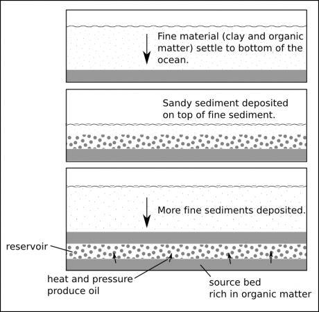
Figure 1. Formation of sandstone (reservoir) and shale (source bed).

Over time, millions of years, this material gets buried beneath other sediments, compressing it and heating it up. Together the organic material and the clay form a type of sedimentary rock called shale. As the shale gets buried deeper and deeper and it gets hotter and hotter, and the organic matter gets cooked which causes it to release the chemical we know as natural gas (methane) and the mixture of organic chemicals we call crude oil (see the formation of oil and natural gas).
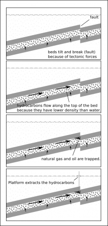
Figure 2. The trapping of oil and natural gas by a fault.

Shale beds tend to be pretty tightly packed, and they slowly release the oil and natural gas into the layers of sediment around them. If these layers are made of sandstone, where there is much more space for fluids to move between the grains of sand, the hydrocarbons will flow along the beds until they are trapped (Figure 2).

In this exercise, we will use the wave tank to simulate the formation of the geologic layers that produce oil.

Materials

  • Wave tank
  • Play sand (10x 20kg bags)
  • Colored sand (2 bags)

Observations

For your observations, you will sketch what happens to the delta in the tank every time something significant changes.

Procedure

  1. Fill the upper half of the tank with sand leaving the lower half empty.
  2. Fill the empty part with water until it starts to overflow at the lower outlet.
  3. Move the hose to the higher end so that it creates a stream and washes sand down to the bottom end — observe the formation of the delta.
  4. Observe how the delta builds out (progrades) into the water.
  5. After about 10 minutes dump the colored sand into the stream and let it be transported onto the delta.
  6. After most of the colored sand has been transported, raise the outlet so that the water level in the tank rises to the higher level. — Note how the delta forms at a new place.
  7. After about 10 more minutes dump another set of colored sand and allow it to be deposited on the delta.
  8. Now lower the outlet to the original, low level and observe what happens.
  9. After about 10 minutes, turn off the hose and drain all of the water from the tank.
  10. When the tank is dry, use the shovel to excavate a trench down the middle of the sand tank to expose the cross-section of the delta.

Analysis

1. How did changing the water level affect the formation of the delta.

-
-
-
-
-
-

2. When you excavated the trench, did you observe the layers of different colored sand in the delta? Draw a diagram showing what you observed. Describe what you observed here.

-
-
-
-
-
-

3. Was this a realistic simulation of the way oil reservoirs are formed. Please describe all of the things you think are accurate, and all of the things you think are not realistic?

-
-
-
-
-
-
Erosion as diffusion

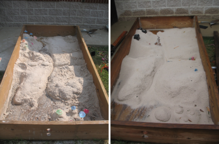
Landforms in the sandbox before and after the rain.

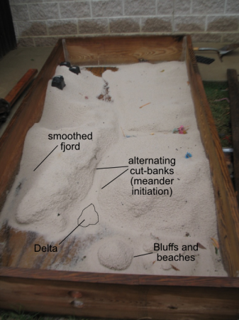
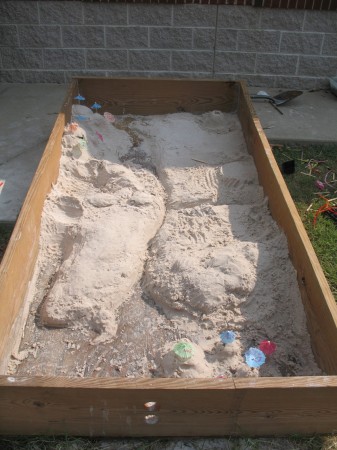
We left the sandbox uncovered under last week’s heavy rain, and the result was a new perspective on erosion, sedimentation and the evolution of landforms.

Nice, sharp, hand-sculpted valleys were smoothed out by the raindrop splatters. The beautifully steep sided fjord on the lower left, in particular, eroded into the gentler slopes of a fluvial surface.

This process is diffusional. Sand moves from high peaks to fill in the low valley floors, evolving toward a softer, flatter land surface in the same way dye in pan diffuses from the high concentration droplet to a more uniform distribution.

There was enough rain that water pooled, for a little while, at the lower end of the sandbox. This allowed the formation of a beautiful little delta from the main river, which was most remarkable to observe while it was raining because the channel bifurcated at its mouth with running water to the left and right of the depositional landform.

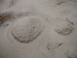
Island bluffs surrounded by sandy beaches.

The standing water in the “ocean” also caused the islands to partially erode at the edges to create steep bluffs overlooking sandy beaches.

And finally, if you looked carefully at the sides of the river channel you could see where the water was beginning to cut into the banks, a little offset on either side, to start the formation of meanders.

Annotated sandbox features.

Norse pyre

Farewell It's a Fish

One of our fish has died. With permission, I’ll let Sage Beasley, the main instigator of the fish tank explain (she does it much more elegantly than I could):

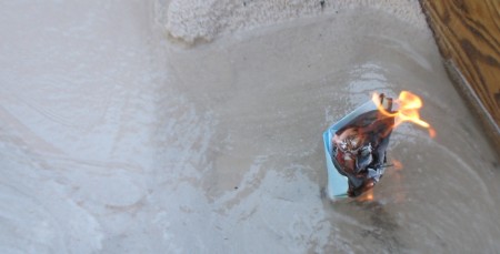
A few weeks ago one of our fish died. Its name was It’s A Fish. I liked the fish. I had gotten him for a Natural world experiment and when we were done with it I put him in a tank at school with the other fish It’s A Whale. It’s A Whale is still alive and healthy. We found a religion for [It’s A Fish] (he’s Norse) and followed their ritual to send the fish into the next life. We put it in a paper boat with vegetable oil and set it on fire. We have released the fish’s spirit to where ever it goes next.
– Sage Beasley (2010), in the Middle School Newsletter.

I’ll just note that every middle school should have a sandbox/watertable.

Physical geography in the sand

Instead of doing the Island of Podiatry in the sandbox, I decided add a practical exercise as part of their Social World test.

Spits, deltas, archipelagos and more.

Half the class, the first to finish the written portion of the test, were instructed, as a group, to create as many physiographic features as they could in the sandbox. Tomorrow, the other half will have to try to identify as many features as they can.

The first group did a very good job. The kids seemed to enjoy working with the sand, and little details, like the difference between a bay and a gulf, quickly became apparent.

It’ll be interesting to see how the other half does with identification. I could not prevent myself from adding a fjord and cirque even though we have not seen them in class. The fjord should at least be recognized as a valley (definitely a steep sided valley), but hopefully this will allow a moment to talk about post-glacial features. Of course, thinking about it, I should probably add a moraine or subsurface ridge to complete the set.

Physical geography in the sand.

City in the sandbox

The City of Apolypse.

My small group that had trouble getting SimCity to behave itself on the laptop decided to go build their city in the sandbox instead.

They had just looked through all the civic buildings and zoning options before they took the outside option, so they started with SimCity’s basic introduction to urban planning concepts.

The group chose to locate their city on the ocean, with a river. Previously, when the class had looked up and down the U.S.’s eastern seaboard in Google Maps, we’d noticed that most of the bigger cities, like New York and Charleston were on or near estuaries. (We’d also noticed that most of the cities were protected by some sort of barrier from the direct influence of the oceans.)

[googleMap name=”New York City” description=”NYC on the river and ocean.” width=”480″ height=”400″ mapzoom=”8″ mousewheel=”false”]New York City[/googleMap]

This group gained some significant advantages over just playing the computer game because the sandbox model allowed them create features not built into the game.

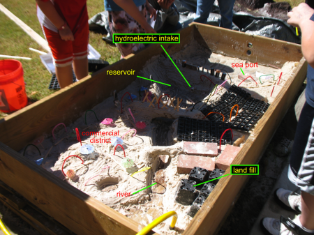
In particular, they sculpted an earthen dam with a hydroelectric power plant, that was the centerpiece of their city.

By putting a dam across the estuary they could acquire both fresh water reservoir and hydroelectric power.

It’s probably not unfair to guess that the idea for the dam came primarily from our visit to the Pickwick Landing Hydroelectric Plant last year. I say so because the eight grader who came up with the idea was reminiscing about last year’s immersions for the rest of the day.

The decline and fall of Apocalypse.

The group did a great job, although they did site their landfill upstream of their reservoir. This became a problem because after they presented to the class they turned on the river. We relearned the biblical lesson about not building on the sand. This was not entirely unexpected though; the students had named the city Apocalypse.

The combination of computer simulation and physical model really worked well. So much so that two years from now, when I do this again, I think I’ll require at least one group to do the physical model. But it really worked for them to have at least seen the computer game so I’ll have to build that into the project too.

Island of Podiatry in the sandbox

I’m not terribly partial to the Island of Podiatry exercise where student produce a map of physiographic features, gulfs, archipelagos, plateaus and so on, starting with the outline of their feet. However, in considering alternatives I was thinking about how it could be made even more real, more tactile. My first thought was of having them sculpt the topography out of modeling clay, but then I realized that this would be a great use for our sandbox.

The weather’s cooled down a bit in the last week, but it should still be warm enough for students to want to be outside. All I’ll need to do is level the box (though this might be no small feat since it’s filled with sand), add about ten centimeters of water, and have them shape the island from their Island of Podiatry map. I’ll also probably need them to decide whose map they want to model.

Oil traps and deltas in the sandbox

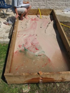
Red and green sand added for marker beds.

The sandbox was built to be a wave tank so we could look at interference patterns and wave properties. But if you tilt it a little, and put in a few holes on the lower end, you can get sandbox to look at the formation of streams, deltas and the sedimentary layering that traps oil and natural gas.

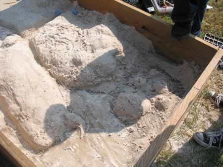
Using the holes at the bottom end the students started with a low “sea-level”, raised it and lowered it. At the end of the run, they drained all the water and sliced the tank to see the depositional layers in cross-section.

We added red and green sand to try to make marker beds before each change in base level. The marker beds worked reasonably well, but it would have been better to have sand with different densities that could be sorted by the stream flow and depositional environment. It also helps to get the colored sand wet, to make a slurry, otherwise the grains will float on the water.

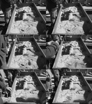
The shifting lobes of the delta showed up very well (see the animation) and some nice river features showed up as well. What I want to do sometime is to have students build coastlines and have waves erode them away creating typical coastal features.

My students were even able to demonstrate the tank for their presentation, because it really only takes half an hour to get all the features if you know what you’re aiming for.

Sources

The exercise these results are based on is posted as The Geology of Oil Traps Activity.