The worst of this spring’s flood has passed Memphis, but they’re still dealing with the water downstream on the Mississippi.
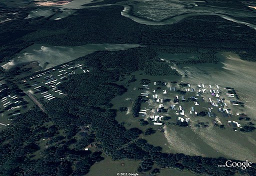
PBS has before and after pictures of the opening of the Morganza Spillway, which is intended to stave off flooding in Baton Rouge and New Orleans.
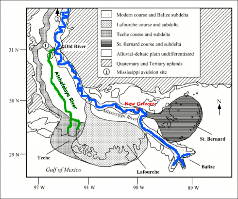
The Coastlines Project blog is also aggregating a lot of information about the effect of the flooding. I found the post on the effect of the flooding on New Orleans) to be particularly provocative. It’s probably a good candidate for a Socratic dialogue, because it points out the tradeoff between the ecology of the Mississippi delta and the health and utility of New Orleans. The Corps of Engineers have been regulating the Mississippi along its present course for the last half a century, but this has prevented the river from avulsing and flowing down the Atchafalaya river instead of its current course. This would leave New Orleans high and dry (but not for long) but be a great boon for the Atchafalaya part of the delta.

Coastlines Project also deals with other issues, such as how the lingering effects of the BP oil spill, affecting the Gulf coast. It’s an interesting blog to follow, especially since we’ll be on that coast next week for our end-of-year trip.