[googleMap name=”Memphis, TN” description=”35 N, 90 W” width=”480″ height=”400″ mapzoom=”1″ mousewheel=”false” directions_to=”false”]35, -90[/googleMap]
Google Maps are a great tool for introducing the five themes of geography because it allows you, as you zoom-in from a distance, to observe things in different ways. The different views, terrain, satellite, map, offer a nice introduction to Geographic Information Systems (GIS) layers; GIS is one of the most powerful technological developments of the information revolution and we’ll be hearing a lot more about it in the next year or so as the political parties try to gerrymander congressional districts into more favorable boundaries.
If you start zoomed out all the way, like in the map above, you get to see your location from a global perspective. Note that if you sign up to the google maps site itself, instead of embedding the map like I have it here, you can select an option so that the cursor shows the latitude and longitude. The largest scale view is best for talking about hemispheres and latitude and longitude. Even better would be to use Google Earth which will show the world as a sphere.
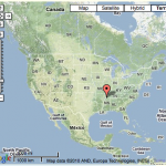
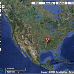
Zooming in a couple times will begin to highlight features of topography and land surface cover, two important physical components of space. Both the terrain and satellite views show this, but sometimes one works better than another so this is a good time to switch back and forth between the two and mention that this is GIS. Looking at North America, the satellite view shows the Rocky Mountain region quite nicely, while the terrain view shows the climatic gradient from the snowy northern Canada to the green Gulf Coast.
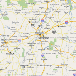
Switching to map view and zooming in a little more, the highway network and to some degree the river networks become more apparent. Google Maps is designed for general use so there’s no easy way to emphasize the importance of the river networks and ocean ports without pointing it out yourself.
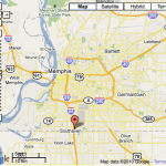
As you get down to the scale of the city itself, a little of the human geography of place becomes visible if you know what you’re looking for. In the case of Memphis, as well as a lot of other cities, the loop highways don’t just direct highway traffic around the city but separates the city itself from its suburbs. There are often significant class, racial and other demographic differences between the populations living within the loop and those outside.
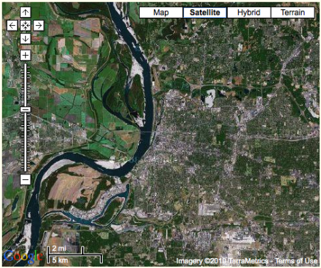
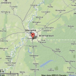
At a scale that covers both the city and its surroundings, the satellite view nicely shows the effects of development on the urban, undeveloped and agricultural environments. In the Memphis region (see the image directly above), the Mississippi River separates the flat, lowland, agricultural floodplains of Arkansas in the west, from the urban and suburban development atop the river bluff to the east; the difference is strikingly obvious. You may also notice the tree lined channels of the east-west flowing tributaries to the Mississippi. They’re relatively narrow but the dark green of the trees are a striking contrast to the light colored concrete and asphalt of the rest of the city.
[googleMap name=”River port” description=”River port” width=”490″ height=”400″ mapzoom=”15″ mousewheel=”false” directions_to=”false”]35.0895, -90.106[/googleMap]
You can use the closer view (especially if you switch the map above to satellite view) to point out the importance of water transportation in most cities by focusing on the port. The railyards are also good to look at because all the material they transport they tend to be hidden away despite their sheer volume.
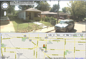
Finally, the street view lets you take a look as some of the ways people adapt to the environment. To truly understand adaptations you really need to contrast different places, which is why the small groups are asked to do this type of analysis for different cities around the world, but if you’re giving a lesson and know what to look for the street view can be a nice introduction. In Memphis, apart from the very southern style of many buildings, we have the shotgun houses that are long and narrow, with front and back doors lined up to permit air flow in the hot humid summers.
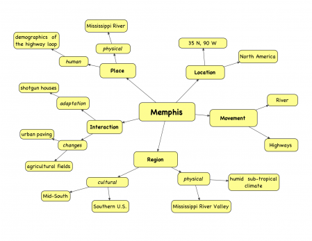
So to sum it all up, I’ve put together this graphic organizer for the five themes of geography for Memphis. It’s not complete of course, but it should have all the examples mentioned in this post. I’ve asked all of my groups to include a similar graphic organizer in their presentation to help pull everything together. We’ll see how it goes.
Beautiful.
A few weeks ago a friend, who is torn between the benefits of Montessori and traditional schools, hosted a seminar at her Educational Resource Center touting computers in the classrooms. As I am rather luddite in the area of technology in Casa and Lower El as well as a Mac person, she invited me. She and I have rather lively debates about the pros and cons of computers and Montessori. It was a lovely presentation. However most of it came down to 1. you can get more data on a child in less time when you give them tests on the Ipad and 2. you can save trees by putting your copies into the Ipad and letting them work and submit on the computer. Agggggggggg.
However, the point is that I have been observing and pushing to find useful ways of integrating the Ipads into our class life in a non-usurping manner. Maps have been the best way so far in Lower El. I have no Casa aged kids I am working with. We just used them to identify land and water form around the globe. The ability to zoom in (scaleable) made it more affective than an atlas.
I can’t wait to try this your work with AV
I’m really looking forward to hearing about how it goes with AV. That’s one of my favorite things about your blog, how much detail you put in about your students’ work.
It’s fascinating how my students use the computers and technology. Some of them need to keep all their study guides printed out and organized in a binder, while others barely use the binder at all. And given the chance, they tend to print out way more than they need so I need to have clear rules in order to save trees.
I’ve not tried the iPad much, mainly because I find it hard to type on a touch screen (I’m always resting my fingers on the keyboard), but I’m curious if you can use Google Earth on one? Being able to pan and fly around in 3D is a very nice capability for looking at landforms.