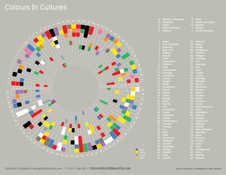
White is the color of marriage, in western countries at least, but for the Hindus and Chinese the color of marriage is red. Information is Beautiful has the wonderful quick reference graphic above.
Middle and High School … from a Montessori Point of View

White is the color of marriage, in western countries at least, but for the Hindus and Chinese the color of marriage is red. Information is Beautiful has the wonderful quick reference graphic above.
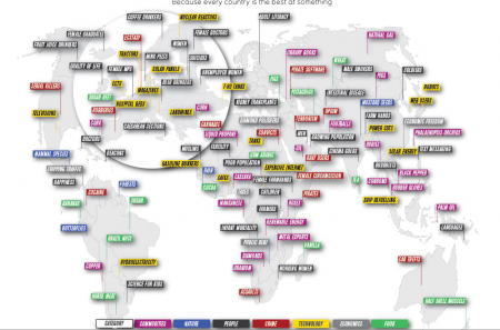
David McCandless has captured more than a little of the wonderful diversity you can find around the world in this map of International Number Ones. It has some thought provoking juxtapositions. The U.S., for example, is #1 for serial killers while Cuba is #1 for doctors.
The map is also interactive in that if you move the cursor over it, the names of the countries show up. This feature is especially fascinating when looking at unfamiliar parts of the world.
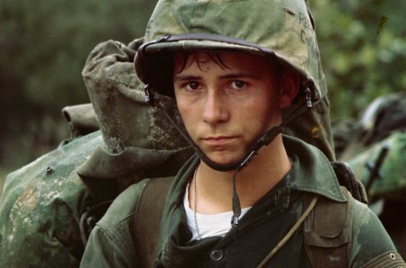
A slew of ideas and conflicts swirl around the Vietnam War: democracy, communism, dictatorship, freedom, colonialism, domino theory, chemical warfare, technology …. We’re supposed to look at wars through the lens of the “Characteristics of War”, but what do offense and defense mean in a war like Vietnam? A close examination of any of these words in the face of Vietnam leaves more questions than answers. The Boston Globe has a heartbreaking collection of images from the Vietnam War that give a remarkably multifaceted view of the conflict and its consequences. The photos are iconic and some are graphic.
The photographs in the Boston Globe were mostly taken by western photographers (some were from the U.S. military), whose journalistic culture inspired them to try to capture all aspects of the war, to tell the whole story, independent of their own allegiance. There were fewer North Vietnamese photographers and their job was to capture images that would promote their side of the war. Even so, some of their photographs are also amazing and offer another perspective.
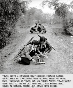
National Geographic collected some of these photos in Another Vietnam: Pictures of the War from the Other Side. More photos are available from SnugMug.com, and National Geographic has a documentary on North Vietnamese photographers called, Vietnam – The Unseen War (a 5 minute preview is available on VEOH).
These images help tell the story of how powerful the media can be, particularly in a democracy. What’s also interesting is the youth of many of the combatants on both sides.
[googleMap name=”Vietnam” width=”490″ height=”350″ mapzoom=”4″ mousewheel=”false” directions_to=”false”]Vietnam[/googleMap]
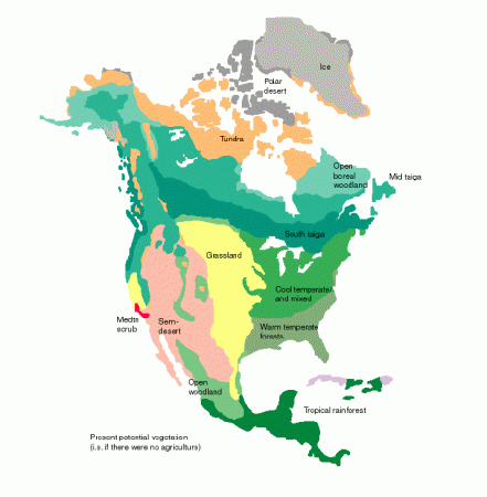
The story of cattle drives and the railroads also has a lot to do with the geography of natural resources in the United States. A few good references:
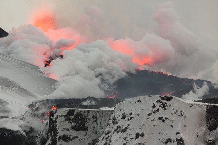
Current events often generate the teachable moments we’re always seeking in order to strike students’ imagination. The eruption of Eyjafjallajökull is a prime example. I’ve already used it to point out the intersection of geothermal energy and plate tectonics, but there is so much more.
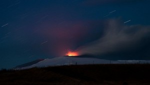
Eyjafjallajökull has been a wonderful subject for the art of photography. The image above is a great example but the time-lapse photos have been excellent. The photo to the right captures not just the stars streaking across the sky with a three minute exposure but the fiery red arcs of the volcanic ejecta.
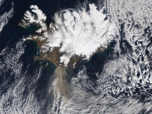
One of the major benefits of the space program so far has been its Earth observing satellites. There is so much going on in the image to the left that it’s hard to know where to start. Why are there all those clouds over Iceland? (warmer land mass creates convection); what’s with the two plumes from the volcano, one concentrated high level and one disperse low level plume; fjords on the upwind side of the island and the straightened coastline on the lee; greenish plumes of glacier-ground, rock flour discharging into the ocean.

The dinosaurs were done in either by an asteroid impact in the Yucatan or the eruption of the massive flood volcanoes in Deccan, India, or quite probably both. Both of these events launched an enormous amount of ash, gas and fine particles into the upper atmosphere, blocking sunlight, causing global cooling. Well the ash from Eyjafjallajökull and the sulfur dioxide gas may be having a similar effect on Europe, and if there’s enough of it, on the world. The 1992 eruption of Mt. Pinatubo cooled the globe by about half a degree Celsius.
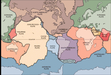
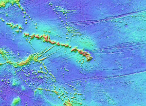
The question came up about where are good places for geothermal energy, and the answer, of course, was to introduce plate tectonics. It was a quick introduction, and a refresher for the 8th graders, but the interest was there and it seemed impactful.
It also provided a link to talk about the Icelandic volcano that’s been disrupting air traffic in Europe. NASA has an amazing picture of the eruption on its Picture of the Day for April 19th.
Google Maps is a great tool for showing features like the mid-ocean ridges (use the satellite view), zooming in and out of the mountain ranges, tracing the Hawaii hotspot and watching East Africa split apart.
[googleMap name=”Mozambique Channel” description=”East African Rifting” width=”400″ height=”350″ mapzoom=”4″ mousewheel=”false” directions_to=”false”]-21, 40[/googleMap]
The Memphis to Charleston line was the only railroad that linked the East Coast of the Confederacy to the fertile Mississippi River Valley. At a time when the fastest way to move troops, supplies and commerce was by river or rail, the Memphis and Charleston railroad was essential (this was well noted in Robert Black’s “The Railroads of the Confederacy”). Cutting the railroad was an important objective of the Union. Cutting it at Corinth Mississippi would also cut the Mobile and Ohio Railroad line which linked the north and south of the Confederacy. Thus the Battle of Shiloh, where the Union could disembark its armies using the Tennessee River, and soon after, the Battle of Corinth.
The Civil War Interpretive Center in Corinth (this is also a good reference) does a nice job of presenting the details of the battles for the town, and their video presentation, with different images projected on multiple screens in a circular room was quite good (though there was a lot of information and you did not know quite which screen to focus on, so some students had trouble keeping track of it all).
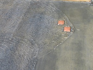
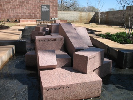
The most interesting part of the center is the Stream of American History which is a wonderful place to learn about metaphors. The stream starts with a fountain that overflows through 13 notches cut in the rim of the basin into a shallow water course that gradually widens as more states are added to the U.S. In the first reach of the stream there are impediments in the paved stream bed that create turbulence, harbingers of the war to come (they create nice standing waves which is an additional point in their benefit).
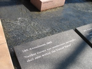
When the stream gets to its main focus, the civil war, large granitic blocks, cut into prisms and labeled with the names of the battles, break the stream into two before it finally merges again as it reaches the reflecting pool.
I threw my students at the Stream without telling them what it was. The only hint I gave was that it was a “large metaphor”. There were enough clues that they could figure it out. They wandered around it individually, with their pencils and notepaper for 15 minutes (I required that they write down their interpretation, then we got them together to pool their thoughts.
The stream is a very nice puzzle, and the National Park Service has a good key (pdf). It was a good way to end our immersion trip, and it gave the students something to think about on the long drive home.
[googleMap name=”Corinth Civil War Interpretive Center” width=”400″ height=”350″ mapzoom=”4″ mousewheel=”false” directions_to=”false”]501 West Linden Street, Corinth, MS[/googleMap]
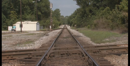
Since we just got back from an immersion trip to Corinth, MS and Shiloh, it was very interesting to find out the PBS has a new Exploring history program: Exploring History: Corinth, Mississippi and Shiloh National Military Park. Check your local station (as they say) or you can find the video online.