Collecting Garbage on the Beach: The Trip to Deer Island

To the left, a long, narrow, lightly-wooded island. Skeletal trees, dying on the upwind end; drowned by the attrition of the waves. To the right, a narrow, eager, urban strip. Hotels and casinos, pressing against the water’s edge; vying for access to the white sand beaches and gentle waters of the sound. Such different places on either side, yet the one on the right is the reason we’ve come to the one on the left. We’re here as part of our Adventure Trip to pick up any artificial debris that’s managed to float across the sound and collect and contaminate the quiet, isolated beaches of the island.

We’d gotten on a pontoon at the research lab right after breakfast, so the early adolescents were still a little groggy. Our vessel’s captain asked a question about team mascots which promptly woke up approximately 63.64% of the class, and served as a topic of conversation for the twenty or so minutes it took to get to the drop-off point on the west-north-western end of Deer Island.
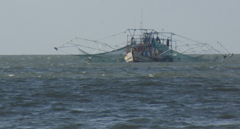
Shrimp boat caught in the act of deploying its nets.

Mostly unobserved by my busy students were the half dozen shrimp boats casting their nets in the sound. Long, spider-like, almost robotic arms spread out from the vessel to lower the nets. It’s quite an impressive sight. Commercial shrimping is a major industry all along the Gulf coast.


Deer Island (and its hike). View Coastal Sciences Camp, Gulf Coast Research Lab in a larger map

Mostly dead trees.

The island itself is long and thin, wedge shaped, no more than a couple hundred meters at its widest at the eastern end, but thinning to less than 100 meters to the west. Although wider, almost all the trees seem to have died on the eastern end. Then there is a gap and the trees are mostly alive. Looking at the satellite image, you can see a clear channel cutting through the island. From the image, I’d guess the channel is tidal, with water moving back and forth, filling and draining the sound with each cycle of the tides. The sediment deposited in the quieter waters of the sound (to the north) seem to be forming a small, white-sand delta; the equivalent deposits on the south are probably washed away by the longshore current pretty quickly since that shore is exposed to the wind and waves.

Deer Island is not an active barrier island: twelve kilometers to the south, Horn and Ship Islands do that job today. However, given the shape of Deer Island, it may have once been a barrier when the coastline was further inland. This is all part of the coastal plains deltas, which includes the Mississippi Delta and smaller rivers. These rivers transport sediment from the mountains inland and deposit them in the ocean, gradually building out the land. As the deltas build out, the barrier islands also push out to accommodate them.
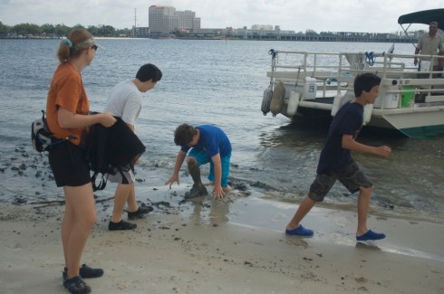
Scrambling for dry land. Note the rich, black mud.

The pontoon pulled up on a broad, sandy beach then retreated to deeper waters where the fishing is better. The white sand beach we landed on was an artifice, just like the East Beach Drive beach we’d walked the day before. Our first steps betrayed the secret. Breaking through a thin cover of sand, we sank knee-deep into a rich black mud that’s the natural sediment in a quiet waterway like the sound.

Our guide, on the other hand, seemed to have a preternatural ability to avoid sinking into the mud, or even getting her feet wet, or even touching the water.
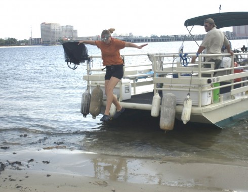
Stephanie, our guide, carefully takes her first few steps off the boat. (no photoshopping was involved in the creation of this image).

References

The first image was distorted using a four point distortion method with ImageMagick.

> convert sc-deer-island-1843.jpg -matte -virtual-pixel transparent -distort Perspective ‘0,0,0,200 0,664,0,564 1000,0,1000,0 1000,664,1000,664’ tst2.jpg

> convert sc-deer-island-1841.jpg -matte -virtual-pixel transparent -distort Perspective ‘0,0,0,0 0,664,0,664 1000,0,1000,200 1000,664,1000,564’ tst.jpg

Blind Sampling of the Subsurface

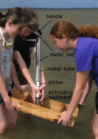
Extruding sediment from the corer into the sieve. Dashed lines indicate where the piston and metal rod extend inside the barrel of the corer.

On the first morning of the Coastal Science Camp, between dip netting and seining at the estuary, we tried sampling beneath the seabed using a little coring device which I seem to have to forgotten the name of.

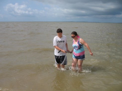
Some students were quite excited about the chance to sample beneath the surface of the sediment. Student displays the sampling device is in his right hand.

Usually, they can see the little holes in the seabed where the benthic macrofauna live, but not this time. All the sediment pouring into the Mississippi Sound from this spring’s swollen rivers had made the waters too turbid to see through. So we were coring blind.

The corer is simply a metal (stainless steel) barrel with a rubber piston inside. The piston is connected to a handle at the top with metal rod. To sample, you put the tip of the barrel at the sediment-water interface and push the barrel into the sediment at the same time holding the handle steady to keep the piston from moving into the sediment. Holding the piston steady provides a little suction on the inside of the barrel, which helps the barrel move into the sediment, and keeps the sediment in the barrel when you pull it out. However, it does help to put your hand on the bottom of the barrel as soon as possible to keep the sediment from falling out, even if that means sticking your hand into the sediment itself.

Keeping you hand on the bottom of the barrel keeps the sediment from falling out before it gets to the sieve.
Vague layering is visible in the sediment.

Once you’ve recovered the sediment, you extrude it into a sieve. Sometimes you can see a little layering in the extruding sediment, but we did not take the time to try to interpret it since our focus was on finding benthic fauna.

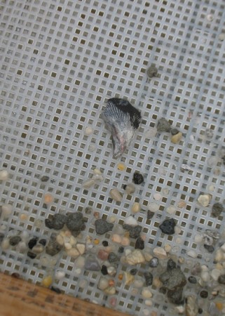
The sieve’s mesh is pretty coarse, so anything sand sized or smaller is washed out as you gently rock it back and forth in the water. We did not find much. Mostly small pebbles. Without being able to see the seabed our sampling pattern was pretty random.

Small pebbles in the sieve.

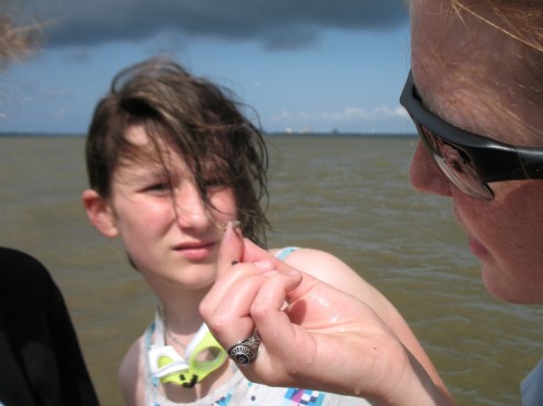
The more persistent groups (the class had been broken into groups of two or three) did find a couple things, including a polychaete, which is a segmented worm.

A polychaete.

They also turned up a small, clawed, lobster-like organism:

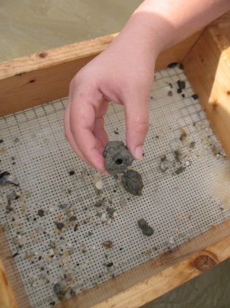
We also found the burrow of an unknown organism, surrounded by a clayey cast. It looked very much like some of the fossilized burrow casts we saw at Coon Creek.

Burrow, with surrounding cast.

This type of sampling was not everyone’s cup of tea, however. Fortunately, the water was shallow and warm, so a good time was had by all.

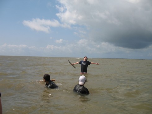
Some groups were less successful at finding benthic macrofauna than others. They had other things on their mind.

Longshore Drift and Pufferfish

A groin strains to hold back the longshore drift. It is, as always, only partially successful.

It was about 1.5 kilometers from the Research Lab to the estuary where we spent our first morning sampling (overview of the trip is here).

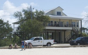
Elevated beach house.

Walking along the beach to get there, we could see the beach houses to the right of us, across the narrow road of East Beach Drive, standing tall on columns to keep them above the reach of the storms. According to Stephanie, our guide, the storm surge from Hurricane Katrina in 2005, reached awfully close to the tops of the columns. The research lab, which is not elevated, lost an entire building to that hurricane. Indeed, much of the coast is still recovering from Katrina’s damage.

The white sandy beach, on the other hand, looked beautiful, which was a bit odd. After all, how did it survive the storm? Furthermore, when you think about it, this beach is located behind a string of barrier islands, which protect the coast from the full force of the waves coming out of the Gulf of Mexico, so how come there is enough wave energy to maintain a sandy beach. The relatively calm waters should allow finer grained sediment, like clay and silt, to settle out, and this area really should be a marsh. The answer, it seems, is that this is an artificial beach. Every few years, thousands of tons of sand are dumped along the coast to “replenish” the beachs.

Without beach replenishment the beaches would revert to salt marshes like this one.

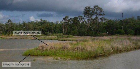
This coastline really should be a tidal marsh, like the one we found when we got to the estuary. These Gulf-coast salt-marshes are fronted by a relatively short version of smooth cordgrass (spartina alterniflora), backed up by the taller, and more common black needlerush (Juncus roemerianus Scheele) .

Longshore Drift

Now, if this is a low-energy environment that allows silt and clay can settle out of the water column, where does the sand go so that it has to be replenished every so often? It is gradually moved along the coast by longshore drift.

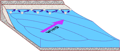
Longshore drift moves sand along the coast in the direction of the wind. Image via the USGS.

Waves hit the beach at an angle. As they break, the turbulent swash pushes sand up the beach at the same angle as the movement of the waves. As the wave retreats, the backwash, drawn by gravity, pulls sand perpendicularly down towards the water. The net effect, is that sand gradually moves down the coastline with each swash and backwash of the waves.

Since dumping tons of sand is expensive, engineers try other things to prevent the sand from running off down the beach. Someone, a very long time ago, had the great idea to build a wall sticking out from the beach to impede the sand in its unwanted migration. This type of wall is called a groin (or sometimes a groyne in polite company), and it does stop the sand. In fact, the sand builds up on the upwind side of the groin. Unfortunately, it does not stop the longshore drift on the downwind side, and that results in the erosion of a bay on that side.

A groin impedes longshore drift. Note that the waves approach the beach at an oblique angle.

Pufferfish

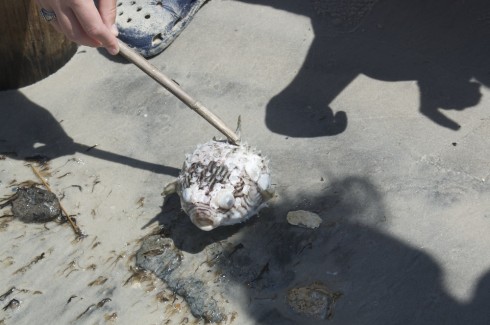
Beaches are also great places to find random things washing up. We lucked upon an unusually large pufferfish (family: tetraodontidae). It was quite puffed up. It was also quite dead.

Pufferfish.

Pufferfish are famous for being extremely poisonous. According to the National Geographic page on pufferfish, their tetrodotoxin over a thousand times more poisonous than cyanide, and there is no known antidote.

Seining in the Sound

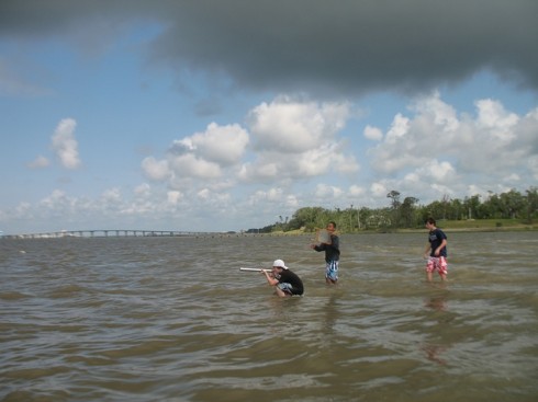
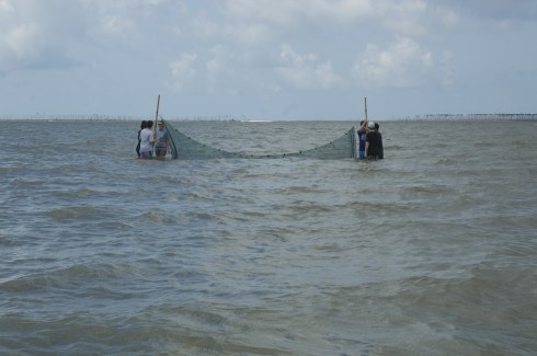
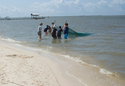
Setting up the seine.

After surface sampling with the dip nets, and subsurface sampling with the little corers, we tried sampling the water column using a small seine.

Seining requires teamwork, and I was pleased to see everyone working well together, focused on the job at hand.

Working together to bring in the catch.

Hauling on the nets, with the smell of salt in the air, resurrected long neglected memories of fishermen at work on tropical, Atlantic beaches. Back then they were going after fish for the market, here, with our much finer meshed net, we were looking for anything interesting in the water column.

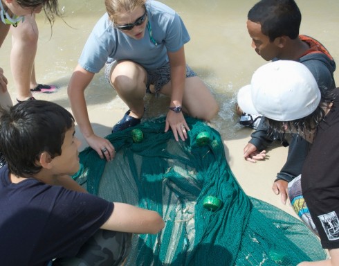
Examining the catch.

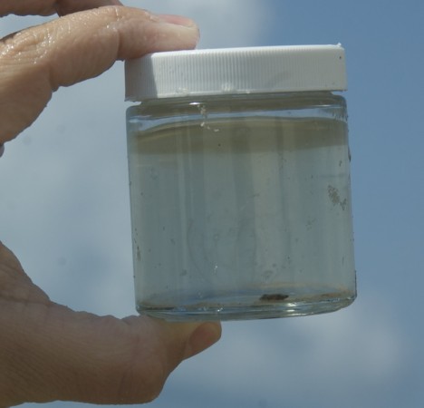
Everyone got touch a ctenophore (comb jelly), which I will note is not a jellyfish, and is also not poisonous.

If you look carefully you can just make out a comb jelly in the jar.

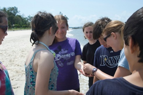
Students also had a chance to hold a croaker (a fish of the family Sciaenidae), and feel it croak.

Feeling the croak.

Our guide was great. She was quite knowledgeable about the fauna we ran into, and very good at sharing information.

Stephanie T. pointing out the finer points of piscine morphology.

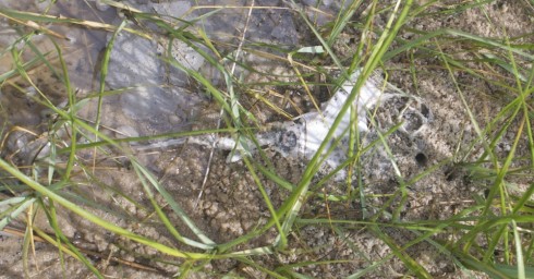
Interestingly, we were not the only ones out seining that morning. There was a small group from the research lab looking for skates for a research project. I think they said that this was their third time out looking, but like us, they did not find any elasmobranchs (not counting the one dead specimen we ran into while dip netting).

Remains of a skate, lying in the grass at the edge of the beach.

Dip Nets in the Estuary

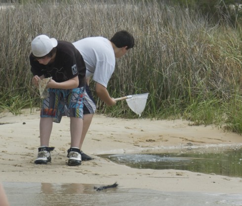
Dip nets in action.
Sampling in the estuary.

Doing the “sting ray shuffle” through the shallow waters of the estuary of a small stream and the Mississippi Sound, we used dip nets to collect organisms from the sediment-water interface.

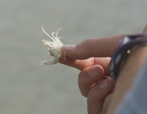
We found mostly invertebrates. There were lots of small white crabs. Most, but not all, were too small to pinch.

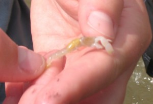
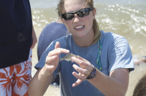
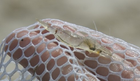
We also grabbed quite a number of translucent shrimp.

You can very clearly see the entire gastro-intestinal system of this small shrimp.

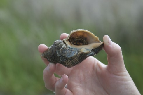
And there were a lot of hermit crabs.

An understandably shy hermit crab.

A couple students also picked up some small snakes, but they quickly slipped through the dip net’s mesh and escaped.

Simple and effective, dip netting was a nice way to start the Coastal Sciences Camp.

Dolphin

Dolphin in the boat's wake.

We weren’t looking for them at the time, and later when we were looking for them we didn’t find them, but on our trip back to the GCRL-MEC a dolphin decided it wanted to play in our boat’s wake.

It would jump through the face of the bow wave. Usually horizontally, but vertically once or twice.

Playing.

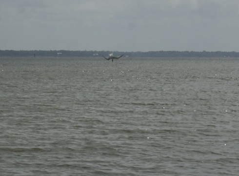
Dolphins usually travel in pods of up to a dozen or so individuals. This one, however, was alone. We’d seen it earlier, while we were walking on the beach and picking up trash. The dolphin may have been playing or eating, but it was certainly scaring the small fish. A couple birds took advantage of this to make their own catches, with near vertical dives into the gently rolling waters of the sound.

It was wonderful to observe.

Bird caught in the middle of a dive, just before it splashed into the water.

Waterspouts

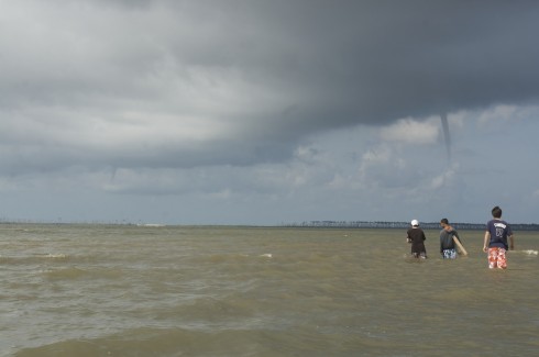
Two waterspouts seen over Ocean Springs.

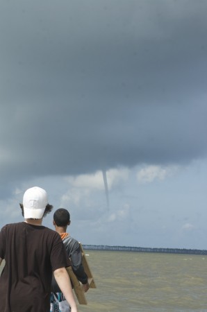
As we waded through the Mississippi Sound, doing the Sting Ray Shuffle, sampling for benthic fauna, we came across these two waterspouts. Our guide, Stephanie, from the Gulf Coast Research Lab’s Marine Education Center, said they’re not that common.

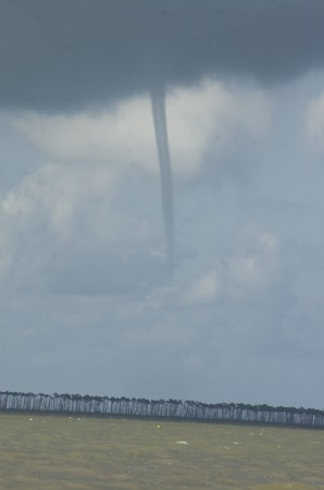
Subtly sinuous.

They’re quite elegant.

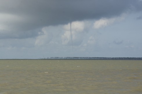
In the distance.

Fortunately, they were very far away.

Fascinating.

Cricket

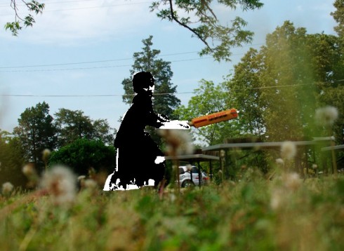
Cricket on the green. J. cuts the the ball toward the cameraperson who is sitting in the covers. Photograph by Sage Beasly, adapted by myself.

The weather has not been nice to our soccer pitch. There’s a bare patch in front of where we put the goals that kicks up a lot of dust when we play. But this also means that the ground is nice an smooth, making for a decent wicket. So we’ve been playing cricket.

I explained the rules and demonstrated batting and bowling, but the habits of a lifetime (even when you’re an early teen) are hard to shake. We’re going through a period where we’re playing an intriguing amalgam of baseball and cricket. Batters are currently straddling the crease with a baseball like stance, which works out pretty well for them at the moment because the bowlers are only just discovering that bouncing the ball makes it harder to hit.

Although I’ve tried to explain LBW, I’m not even going to try to get into some of the more wonderful terminology of the game. The BBC’s cricket Laws & Equipment and Skills pages are quite detailed.