Terraforming Mars

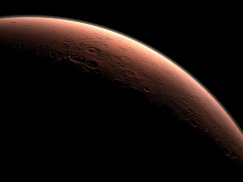
Image Credit: NASA/JPL-Caltech

Jason Shankel has an article on how we could go about changing the surface of Mars into something humans can live on. He does an excellent job of condensing the not insignificant literature on terraforming the red planet.

Starting with an explanation of Mars’ geologic history, Shankel addresses Martyn Foggs’ list of critical challenges:

  1. The surface temperature must be raised
  2. The atmospheric pressure must be increased
  3. The chemical composition of the atmosphere must be changed
  4. The surface must be made wet
  5. The surface flux of UV radiation must be reduced

— Shankel (2011): How We Will Terraform Mars on io9.com.
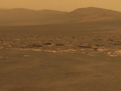
The Martian Surface as seen by the rover Opportunity. Image Credit: NASA/JPL-Caltech/Cornell/ASU

The article is expansive in its detail, provides a wonderful primer on the red planet, and demonstrates an excellent application of planetary system science (as opposed to Earth system science) to what would be an enormous geoengineering project. For example, to warm up the planet, Shankel starts with several approaches:

so how do we warm up the Martian poles? Several approaches have been suggested, from spreading dark material on the poles to lower their albedo, to industrial ice farming to good old fashioned thermonuclear detonations.

— Shankel (2011): How We Will Terraform Mars on io9.com.

He then goes into detail. Lots of detail, in a quite readable form.
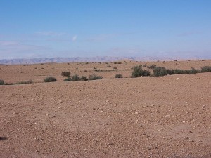
A desert in Algeria. Image by islapics via Wikimedia Commons.

Visit to the Quarry/Landfill

We discussed quite a variety of topics just based on the visit to the landfill/quarry.

A single, half-day, visit to the landfill and quarry brought up quite the variety of topics, ranging from the quarry itself, to the reason for the red colors of the cliff walls, to the uses of the gases that come out of the landfill. I still have not gotten to the details about the landfill itself, but I’ve put together a page that links all my posts about the quarry and landfill so far.

There was so much information that we spent the better part of the following week debriefing it in the middle-school science class.

Click the image for more details.

The map below gives a good aerial view of the site.


View Landfill and Quarry (as of 11/26/2011) in a larger map

The Water Cycle … at the Quarry

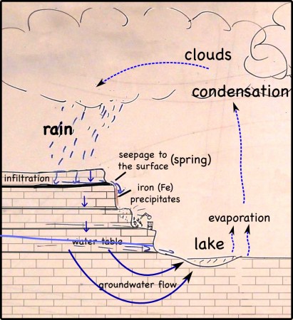
The water cycle, at the quarry.

The water cycle is intricately tied to all the other topics that came up on our visit to the quarry/landfill. For some things, the tie to water is direct and inextricable.

  • It’s groundwater that dissolves the pyrite in the coal seam and then precipitates an orange iron stain on the quarry cliffs.
  • Rainwater seeping into the landfill leaches out chemicals that have to be prevented from getting into the groundwater, rivers or lakes.
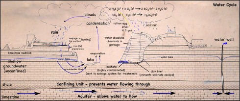
  • Gases like hydrogen sulfide can react with water (and oxygen) in the air to produce acid rain. Not to mention that water is needed for the decaying processes that produce the hydrogen sulfide, and other landfill gases like methane, to begin with.

For other things the link to water is not necessarily so obvious:

  • The sediment that was compressed into the limestone that is being quarried, was formed beneath the shallow seas that once covered this region in the geologic past. Limestone is also dissolved by rainwater to create caverns, underground rivers and spaces for geodes.
  • Methane gas not only requires water for it to be released via decomposition of garbage, but also produces carbon dioxide when burned. Carbon dioxide is a greenhouse gas, so it affects the global temperature and contributes to the melting glaciers, rising sea levels and changes in climatic patterns such as the amount of rain we’re going to receive in the midwest.

The water cycle picture starts simply, but gets complicated very quickly.

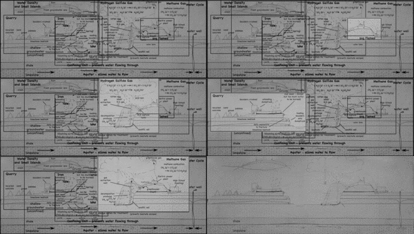
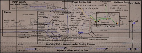
A bigger, fuller picture of the water cycle as it interacts with the quarry.

Limestone Quarry

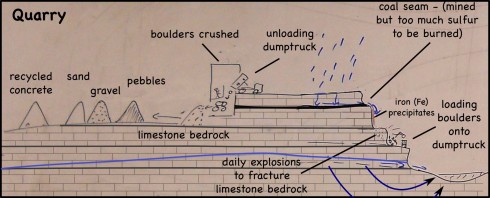
The quarry's primary purpose is to extract limestone for construction.

The landfill/quarry we visited was originally a limestone quarry; once they had the hole in the ground they needed to fill it with something so why not trash (and why not get paid to fill it).

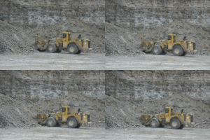
Shoveling boulders. The rock pieces look small but only because the shovel is so big.

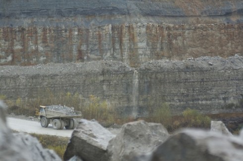
The limestone bedrock is blasted daily to create some massive boulders. The boulders are then loaded on some equally massive dumptrucks. There are scarce few minutes between trucks, so a lot of rocks are being moved.

Dumptruck moving rocks. Massive boulders in the foreground.
Unloading dumptruck.

The trucks then dump their load into a large building where the rocks are crushed. Our guide made us stop the bus to watch the process. While watching a dumptruck unloading might seem mundane, the enormous size of the truck and its boulder load did seem to captivate the students.

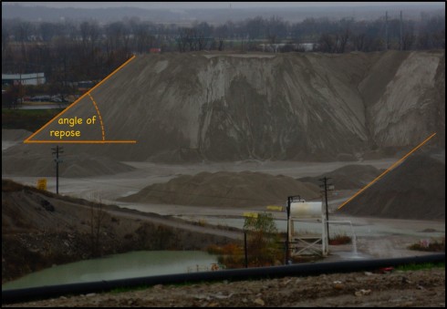
Once the rocks are crushed, the resulting sediment is sorted by size (sand, pebbles and gravel, I think) and piled up. The piles are massive. I’ve been wanting a good picture that shows the angle of repose; I got several.

The angle of repose of a pile of sediment. Also notice the greenish color of the water in the pond to the bottom left. Water with lots of fine limestone particles (silt) and dissolved limestone, tends to have that color.

The pebbles and gravel are used for road construction and provide a matrix for concrete.

Since limestone dissolves fairly easily in rainwater, the sand-sized and smaller particles (< 2mm diameter) aren't used for construction -- hard, insoluble quartz sand is preferred.

Limestone: calcium carbonate (CaCO3)

However, the limestone sediment piles sit out in the open and some the finer grains (silt sized particularly), and any dissolve calcium carbonate, get washed into the nearby ponds, which turn a beautiful, bright, milky green.

Finally, in addition to the limestone sediment piles, there is also one enormous pile of broken up concrete. One of the things that stuck with the students was that fact that you can recycle concrete.

Gypsum on Mars

Suspected gypsum vein on Mars. Image taken by the Opportunity Rover. Image credit: NASA/JPL-Caltech/Cornell/ASU.

NASA thinks their rover has found veins of gypsum on Mars. If they have, it will be an excellent indication that there was once standing water on Mars — gypsum is usually precipitated in evaporating lakes — and will excite the search for life on Mars.

What gypsum veins on Earth look like: white gypsum veins from Somerset, UK. Image by Ashley Dace. (via Wikipedia)

The Freezing Core Keeps the Earth Warm

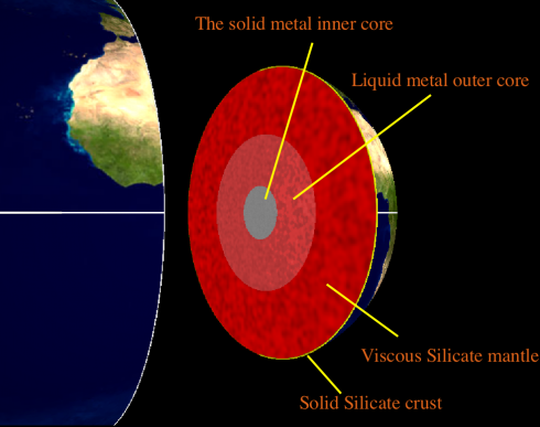
The internal structure of the Earth.

The inner core of the Earth is made of solid metal, mostly iron. The outer core is also made of metal, but it’s liquid. Since it formed from the solar nebula, our planet has been cooling down, and the outer core has been freezing onto the inner core. Somewhat counter-intuitively, the freezing process is a phase change that releases energy – after all, if you think about it, it takes energy to melt ice.

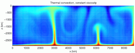
The energy released from the freezing core is transported upward through the Earth’s mantle by convection currents, much like the way water (or jam) circulates in a boiling pot. These circulating currents are powerful enough to move the tectonic plates that make up the crust of the earth, making them responsible for the shape and locations of the mountain ranges and ocean basins on the Earth’s surface, as well as the earthquakes and volcanics that occur at plate boundaries.

Conceptual drawing of assumed convection cells in the mantle. (via The Dynamic Earth from the USGS).

Eventually, the entire inside of the earth will solidify, the latent heat of fusion will stop being released, and tectonics at the surface will slow to a stop.

The topic came up when we were talking about the what heats the Earth. Although most of the energy at the surface comes from solar radiation, students often think first of the heat from volcanoes.

Note: An interesting study recently published showed that although the core outer core is mostly melting, in some places it’s freezing at the same time. Unsurprising given the convective circulation in the mantle.

Model of convection in the Earth's mantle. Notice that some areas on the mantle are hotter, creating hot plumes, and some are cooler (image from Wikipedia).

Note 2: Convection in the liquid outer core is what’s responsible for the Earth’s magnetic field, and explains why the magnetic polarity (north-south) switches occasionally. We’ll revisit this when we talk about electricity and dynamos.

Seismic Waves Across the U.S.

Excellent video from the EarthScope project, showing the seismic waves from the August 23rd earthquake zipping across the United States. Note that the height of the wave was only 20 micrometers (20 millionths of a meter or 0.02 mm) as it passed through the midwest.

One question that might occur is, why are there so many seismic stations in the middle of the continent? My guess is that it has to do with monitoring of the New Madrid fault zone, which produced

More details about the earthquake can be found on its IRIS page.

(via Bad Astronomy)

Live from 1500 Meters Deep

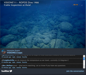
Link to live video feed from the ROV ROPOS surveying a cable on the ocean floor at the Juan de Fuca midocean ridge.

Live science. The remotly operated submersible ROV ROPOS is surveying an undersea cable recently laid across the the Juan de Fuca midocean ridge.

This scientific expedition will be going on until the end of August, and there’ll be live feeds every time the rover is deployed (which depends a bit on the weather at the surface).

If you have questions, they’re also answering your tweets.

Right now, the rover’s heading toward the caldera of the axial seamount volcano. It should get there some time tonight (if they don’t have to stop for anything). So far, we’ve seen dumbo octopuses, crabs, weird fish, brainless worms, sponges, deep sea corals, starfish and lots of pillow basalt. The basalts are unsurprising because these are the rocks produced when volcanos erupt under water.

Dumbo octopus (from the ROV ROPOS seafloor gallery at Interactive Oceans).